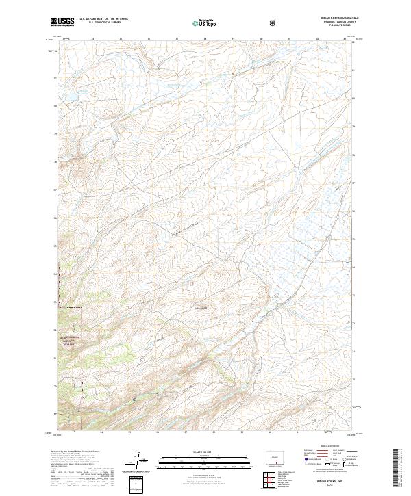
2021 Map of Indian Rocks
USGS Topo · Published 2021About this map
Indian Rocks stands as a prominent geological landmark in this high-altitude landscape within Carbon County, Wyoming. The terrain is defined by an intricate network of irrigation systems and natural watercourses, including the Haines Ditch, Cherokee Ditch, and Dunkard Ditch, which indicate the region's managed water resources for ranching or agricultural use. A portion of the Medicine Bow National Forest occupies the southwestern corner, where the topography becomes increasingly complex with drainage systems like Chippewa Cr and Beaver Cr feeding into larger basins.
Find a feature on this map
33 named features on this map. Tap any name to fly to it.
Don’t see what you’re looking for? This feature index may not catch every label — zoom into the map to look around manually.
Map Details
Editions of this 2021 Indian Rocks Map
This is the sole edition of this map. No revisions or reprints were ever made.
Other maps of this area

1932 · Savery
USGS Topo · 1:96,000

1939 · Saratoga
USGS Topo · 1:125,000

1940 · Savery
USGS Topo · 1:125,000

1954 · Rawlins
USGS Topo · 1:250,000

1958 · Rawlins
USGS Topo · 1:250,000

1961 · Red Mountain
USGS Topo · 1:24,000

1961 · Bridger Peak
USGS Topo · 1:24,000

1961 · Encampment
USGS Topo · 1:24,000

1961 · Jack Creek Reservoir
USGS Topo · 1:24,000
1961 · Saratoga
USGS Topo · 1:24,000