
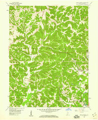
1956 Map of Indian Springs
USGS Topo · Published 1959About this map
The Crane Naval Ammunition Depot dominates the northern half of this mid-century landscape, its sprawling reservation boundary cutting through the rural hills of Martin and Lawrence counties. The southern reaches of the map reveal a deeply established agricultural and religious community, anchored by numerous family and church burial sites such as Salem Cem, Waggoner Cem, and Carr Cem. The Chicago Milwaukee St Paul and Pacific railroad winds through the terrain, connecting the settlements of Indian Springs and Cale. A notable historical artifact is the Treaty Line etched into the topography south of Goldsberry, marking a legacy of early land divisions. Natural landmarks like Gobbler Knob and Bear Hill overlook the creek valleys of Indian Creek and Sulphur Creek, defining a landscape where public forest and military reservations meet private homesteads.
Find a feature on this map
48 named features on this map. Tap any name to fly to it.
Don’t see what you’re looking for? This feature index may not catch every label — zoom into the map to look around manually.
Map Details
Editions of this 1956 Indian Springs Map
2 editions found
Other maps of this area

1935 · Oolitic
USGS Topo · 1:48,000

1942 · Oolitic
USGS Topo · 1:62,500

1948 · Huron
USGS Topo · 1:24,000

1950 · Huron
USGS Topo · 1:24,000

1950 · Shoals
USGS Topo · 1:24,000

1950 · Odon
USGS Topo · 1:24,000

1956 · Loogootee
USGS Topo · 1:24,000

1956 · Koleen
USGS Topo · 1:24,000

1956 · Vincennes
USGS Topo · 1:250,000

1957 · Vincennes
USGS Topo · 1:250,000