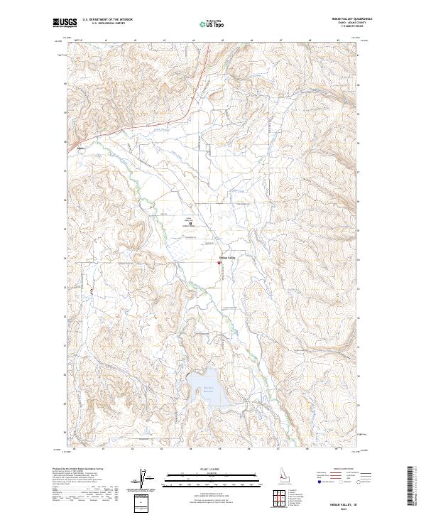
2024 Map of Indian Valley
USGS Topo · Published 2024About this map
Indian Valley serves as a central point in this rural landscape, situated near the confluence of the Little Weiser River and Grays Creek. The area is characterized by a network of drainage systems and family-named roads such as Whiteman Ln, Moritz Ln, and Murphy Ln, reflecting a long-standing ranching and agricultural presence. To the west, the settlement of Alpine sits along the river's path, while the southern portion of the quadrangle is dominated by the Ben Ross Reservoir, a significant water feature managed for local irrigation and conservation. Cultural markers like the Indian Valley Cemetery provide focal points for genealogical research, while the surrounding terrain is defined by rugged gulches, including Ross Gulch and Monday Gulch. The road network, comprising routes like W Indian Valley Rd and N Grays Creek Rd, connects these remote homesteads and water sources across the Adams County countryside.
Find a feature on this map
39 named features on this map. Tap any name to fly to it.
Don’t see what you’re looking for? This feature index may not catch every label — zoom into the map to look around manually.
Map Details
Editions of this 2024 Indian Valley Map
This is the sole edition of this map. No revisions or reprints were ever made.
Other maps of this area

1894 · Squaw Creek
USGS Topo · 1:125,000

1897 · Weiser
USGS Topo · 1:125,000

1911 · Meadows
USGS Topo · 1:125,000

1954 · Council
USGS Topo · 1:62,500

1955 · Baker
USGS Topo · 1:250,000

1957 · Cambridge
USGS Topo · 1:62,500

1957 · Crane Creek Reservoir
USGS Topo · 1:62,500

1959 · Baker
USGS Topo · 1:250,000

1970 · Granger Butte
USGS Topo · 1:24,000
1970 · Twin Sisters
USGS Topo · 1:24,000