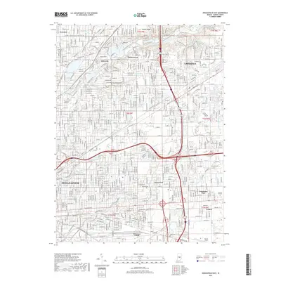
2019 Map of Indianapolis East
USGS Topo · Published 2019About this map
Indianapolis and the city of Lawrence anchor this urban landscape, where the densest residential and commercial developments meet established neighborhoods like Millersville and Brendonwood. The area's hydrology is defined by the winding course of Fall Creek, which is paralleled by the Fall Creek Greenway and fed by smaller tributaries such as Devon Cr and Pogues Run. In the southern portion of the sheet, the corridor around Pleasant Run and the Muddy Pleasant Run provides a green buffer within the grid.
Find a feature on this map
42 named features on this map. Tap any name to fly to it.
Don’t see what you’re looking for? This feature index may not catch every label — zoom into the map to look around manually.
Map Details
Editions of this 2019 Indianapolis East Map
This is the sole edition of this map. No revisions or reprints were ever made.
Other maps of this area

1948 · Indianapolis East
USGS Topo · 1:24,000

1948 · Maywood
USGS Topo · 1:24,000

1948 · Beech Grove
USGS Topo · 1:24,000

1948 · Indianapolis West
USGS Topo · 1:24,000

1952 · Cumberland
USGS Topo · 1:24,000

1952 · Fishers
USGS Topo · 1:24,000

1952 · Carmel
USGS Topo · 1:24,000

1952 · Mc Cordsville
USGS Topo · 1:24,000

1953 · Acton
USGS Topo · 1:24,000

1953 · Cincinnati
USGS Topo · 1:250,000
Featured Places
- Indianapolis, IN
- Lawrence, Indianapolis
- Warren Park, Indianapolis
- Dawnbury, Indianapolis
- Brendonwood, Indianapolis