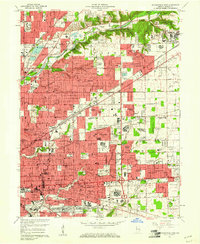
1959 Map of Indianapolis East
USGS Topo · Published 1961About this map
Fall Creek winds through the northern landscape of this Indiana study, defining a corridor of growth where older crossroads like Millersville meet mid-century suburban expansions such as Windsor Village and Avalon Hills. The industrial and defense footprint of the era is prominent, anchored by the Fort Benjamin Harrison Military Reservation in the northeast and the large Naval Avionics Facility further south.
Find a feature on this map
130 named features on this map. Tap any name to fly to it.
Don’t see what you’re looking for? This feature index may not catch every label — zoom into the map to look around manually.
Map Details
Editions of this 1959 Indianapolis East Map
This is the sole edition of this map. No revisions or reprints were ever made.
Other maps of this area

1948 · Indianapolis East
USGS Topo · 1:24,000

1948 · Maywood
USGS Topo · 1:24,000

1948 · Beech Grove
USGS Topo · 1:24,000

1948 · Indianapolis West
USGS Topo · 1:24,000

1952 · Cumberland
USGS Topo · 1:24,000

1952 · Fishers
USGS Topo · 1:24,000

1952 · Carmel
USGS Topo · 1:24,000

1952 · Mc Cordsville
USGS Topo · 1:24,000

1953 · Acton
USGS Topo · 1:24,000

1953 · Cincinnati
USGS Topo · 1:250,000
Featured Places
- Indianapolis, IN
- Lawrence, Indianapolis
- Warren Park, Indianapolis
- Dawnbury, Indianapolis
- Brendonwood, Indianapolis