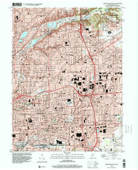
1998 Map of Indianapolis East
USGS Topo · Published 2001About this map
Fort Benjamin Harrison and the adjacent State Park & Nature Preserve anchor the northeastern corner of this late 20th-century landscape, where the urban grid of Indianapolis meets established suburban enclaves. The map detail reflects a densely developed community characterized by a high concentration of neighborhood schools and parish institutions, such as Scecina High School, St Philip Neri School, and Lady of Lourdes School.
Find a feature on this map
105 named features on this map. Tap any name to fly to it.
Don’t see what you’re looking for? This feature index may not catch every label — zoom into the map to look around manually.
Map Details
Editions of this 1998 Indianapolis East Map
This is the sole edition of this map. No revisions or reprints were ever made.
Other maps of this area

1948 · Indianapolis East
USGS Topo · 1:24,000

1948 · Maywood
USGS Topo · 1:24,000

1948 · Beech Grove
USGS Topo · 1:24,000

1948 · Indianapolis West
USGS Topo · 1:24,000

1952 · Cumberland
USGS Topo · 1:24,000

1952 · Fishers
USGS Topo · 1:24,000

1952 · Carmel
USGS Topo · 1:24,000

1952 · Mc Cordsville
USGS Topo · 1:24,000

1953 · Acton
USGS Topo · 1:24,000

1953 · Cincinnati
USGS Topo · 1:250,000
Featured Places
- Indianapolis, IN
- Lawrence, Indianapolis
- Warren Park, Indianapolis
- Dawnbury, Indianapolis
- Brendonwood, Indianapolis