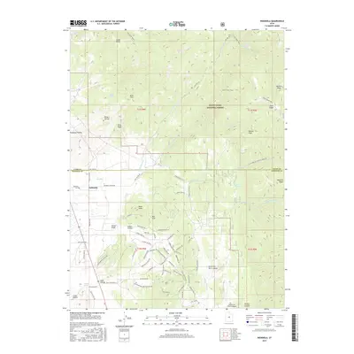
2017 Map of Indianola
USGS Topo · Published 2017About this map
Indianola sits at the junction of several drainage systems in this 2017 study of the central Utah landscape. The settlement is positioned near the confluence where Thistle Cr meets Indianola Canyon Rd, framed by high features such as Poison Ridge and Black Hawk. To the north, the terrain transitions into the Manti-Lasal National Forest, a region defined by complex ridgelines like Beehive Ridge and Jones Ridge.
Find a feature on this map
82 named features on this map. Tap any name to fly to it.
Don’t see what you’re looking for? This feature index may not catch every label — zoom into the map to look around manually.
Map Details
Editions of this 2017 Indianola Map
This is the sole edition of this map. No revisions or reprints were ever made.
Other maps of this area

1885 · Manti
USGS Topo · 1:250,000

1895 · Manti
USGS Topo · 1:250,000

1951 · Moroni
USGS Topo · 1:62,500

1952 · Santaquin Peak
USGS Topo · 1:62,500

1956 · Price
USGS Topo · 1:250,000

1960 · Price
USGS Topo · 1:250,000

1962 · Price
USGS Topo · 1:250,000

1965 · Fairview Lakes
USGS Topo · 1:24,000
1967 · Indianola
USGS Topo · 1:24,000
1967 · Mill Fork
USGS Topo · 1:24,000