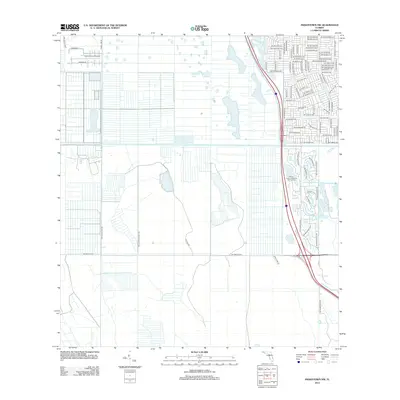
2012 Map of Indiantown NW
USGS Topo · Published 2012About this map
Treasure Coast Airpark anchors the northwestern corner of this Florida landscape, illustrating the blend of aviation infrastructure and residential planning characteristic of the region's 21st-century development. The map reveals a structured grid of planned residential streets such as SW Aragon Ave and SW Malaga Ave in the northeast, contrasting with the more open, agricultural tracts bisected by SW Martin Hwy and SW Allapattah Rd.
Find a feature on this map
87 named features on this map. Tap any name to fly to it.
Don’t see what you’re looking for? This feature index may not catch every label — zoom into the map to look around manually.
Map Details
Editions of this 2012 Indiantown NW Map
This is the sole edition of this map. No revisions or reprints were ever made.
Other maps of this area

1948 · Palm City
USGS Topo · 1:24,000

1948 · Ankona
USGS Topo · 1:24,000

1950 · Ankona
USGS Topo · 1:24,000

1950 · Palm City
USGS Topo · 1:24,000

1953 · Okeechobee 4 SE
USGS Topo · 1:24,000

1953 · Okeechobee 1 SE
USGS Topo · 1:24,000

1953 · Okeechobee 4 NE
USGS Topo · 1:24,000

1953 · Indian Town SE
USGS Topo · 1:24,000

1953 · Indian Town NW
USGS Topo · 1:24,000

1953 · Fort Pierce SW
USGS Topo · 1:24,000