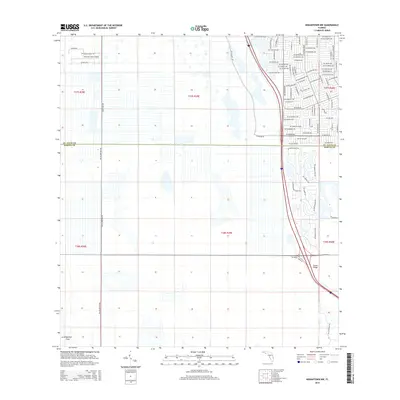
2015 Map of Indiantown NW
USGS Topo · Published 2015About this map
Treasure Coast Airpark anchors the northwestern corner of this Florida landscape, where aviation-themed residential development meets the expansive rural terrain of the St. Lucie and Martin County border. The map captures a period of significant suburban expansion in the northeast, characterized by a dense grid of residential streets including SW Savona Blvd and SW Rosser Blvd. In contrast to the developed residential sectors, the southern and western portions of the quadrangle remain dominated by large-scale agricultural parcels and natural areas such as the Allapattah Flats. This transition from the structured street networks of Port Saint Lucie to the open drainage and range lands defined by Range Line Rd and SW Allapattah Rd illustrates the edge of suburban sprawl during this era. Traceable features like Green Ridge provide localized landmarks within the broader grid system.
Find a feature on this map
94 named features on this map. Tap any name to fly to it.
Don’t see what you’re looking for? This feature index may not catch every label — zoom into the map to look around manually.
Map Details
Editions of this 2015 Indiantown NW Map
This is the sole edition of this map. No revisions or reprints were ever made.
Other maps of this area

1948 · Palm City
USGS Topo · 1:24,000

1948 · Ankona
USGS Topo · 1:24,000

1950 · Ankona
USGS Topo · 1:24,000

1950 · Palm City
USGS Topo · 1:24,000

1953 · Okeechobee 4 SE
USGS Topo · 1:24,000

1953 · Okeechobee 1 SE
USGS Topo · 1:24,000

1953 · Okeechobee 4 NE
USGS Topo · 1:24,000

1953 · Indian Town SE
USGS Topo · 1:24,000

1953 · Indian Town NW
USGS Topo · 1:24,000

1953 · Fort Pierce SW
USGS Topo · 1:24,000