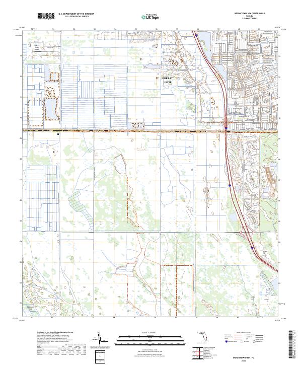
2024 Map of Indiantown NW
USGS Topo · Published 2024About this map
Port St. Lucie expands into the northeastern quadrant of this landscape, where a dense suburban street grid meets the sprawling natural wetlands of the Allappattah Flats. The transition from structured development to conservation land is sharp, defined by the County Line Canal which separates the residential blocks of St. Lucie Co from the preservation areas of Martin Co. Aviation history in the region is marked by the Treasure Coast Airpark, situated near the western edge of the developing corridor. To the south, the terrain shifts into the wet prairies and marshy lowlands of Cane Slough and the elevated ground of Green Ridge. This area illustrates the late-20th and early-21st-century push to balance coastal urbanization with the protection of Florida’s unique interior hydrology, visible through the preservation of the Allappattah Flats Trl.
Find a feature on this map
80 named features on this map. Tap any name to fly to it.
Don’t see what you’re looking for? This feature index may not catch every label — zoom into the map to look around manually.
Map Details
Editions of this 2024 Indiantown NW Map
This is the sole edition of this map. No revisions or reprints were ever made.
Other maps of this area

1948 · Palm City
USGS Topo · 1:24,000

1948 · Ankona
USGS Topo · 1:24,000

1950 · Ankona
USGS Topo · 1:24,000

1950 · Palm City
USGS Topo · 1:24,000

1953 · Okeechobee 4 SE
USGS Topo · 1:24,000

1953 · Okeechobee 1 SE
USGS Topo · 1:24,000

1953 · Okeechobee 4 NE
USGS Topo · 1:24,000

1953 · Indian Town SE
USGS Topo · 1:24,000

1953 · Indian Town NW
USGS Topo · 1:24,000

1953 · Fort Pierce SW
USGS Topo · 1:24,000