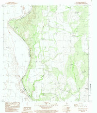
1983 Map of Indio Creek
USGS Topo · Published 1983About this map
The Rio Bravo Rio Grande serves as the prominent international boundary on this 1980s-era survey, separating Texas from Mexico. The landscape is defined by the arid brushland of Maverick County, where a network of water catchment systems like Old Rock Tank, Coyote Tank, and Buena Vista Tank reveal the vital necessity of water management for local ranching and agriculture. Along the Mexican side of the river, small settlements such as San Jose, San Vicente, and Castillon are documented, including a small Cem near the riverbank. This map provides a detailed view of the winding course of Indio Creek as it flows toward the international border, capturing the quiet geography of this cross-border region before modern developments altered the rural character of the river valley.
Find a feature on this map
19 named features on this map. Tap any name to fly to it.
Don’t see what you’re looking for? This feature index may not catch every label — zoom into the map to look around manually.
Map Details
Editions of this 1983 Indio Creek Map
This is the sole edition of this map. No revisions or reprints were ever made.
Other maps of this area

1940 · Cometa
USGS Topo · 1:62,500

1940 · Eagle Pass
USGS Topo · 1:62,500

1941 · Botella Creek
USGS Topo · 1:62,500

1957 · Indio Creek
USGS Topo · 1:62,500

1957 · Botella Creek
USGS Topo · 1:62,500

1958 · Eagle Pass
USGS Topo · 1:250,000

1965 · Eagle Pass
USGS Topo · 1:250,000
1982 · Tovar Creek East
USGS Topo · 1:24,000
1982 · Indio Tank
USGS Topo · 1:24,000
1982 · Farias Ranch
USGS Topo · 1:24,000