
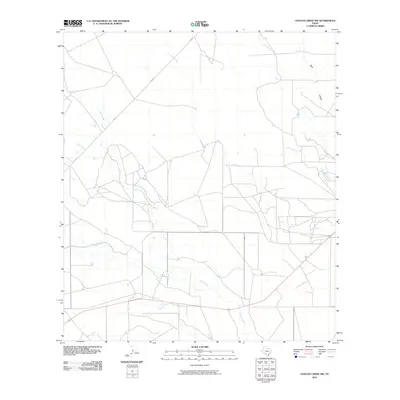
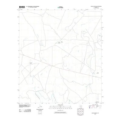
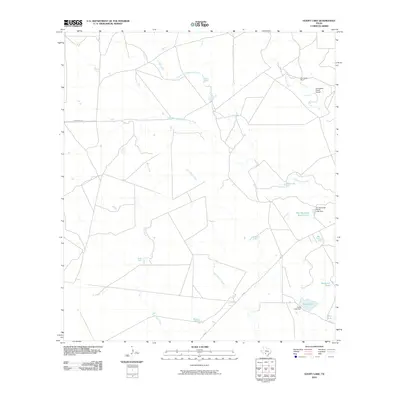
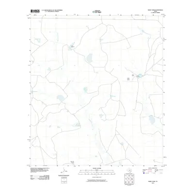
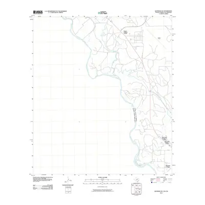
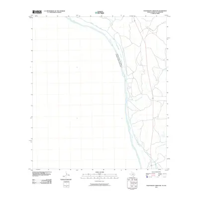
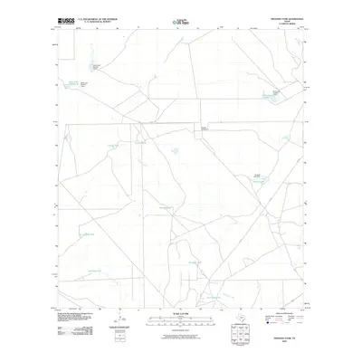
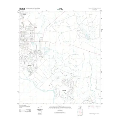
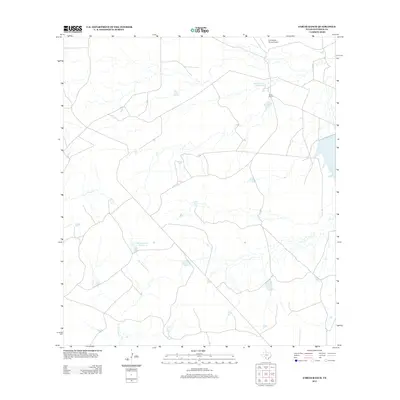
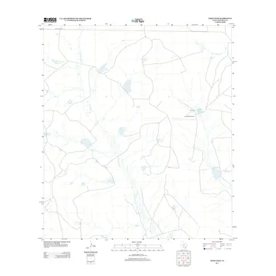
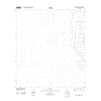
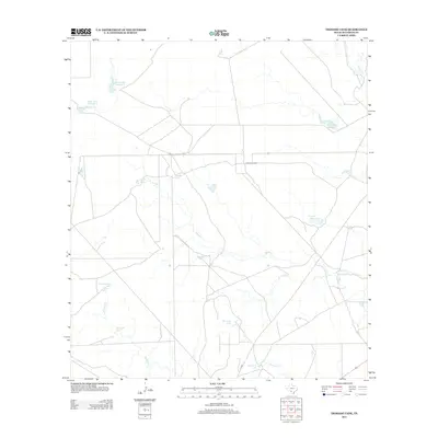
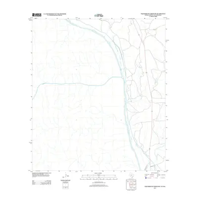
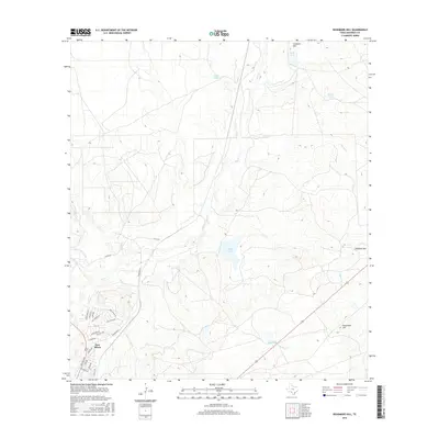
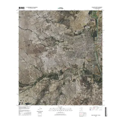
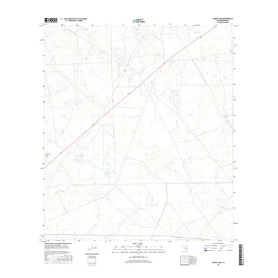
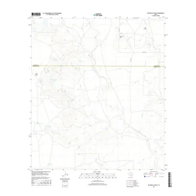
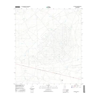
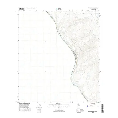
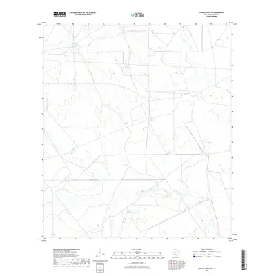
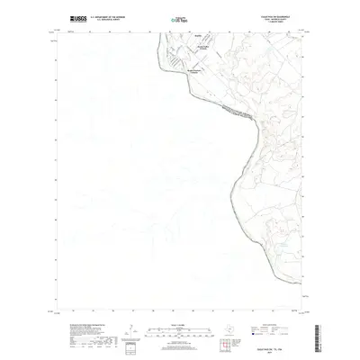
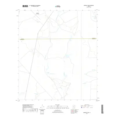
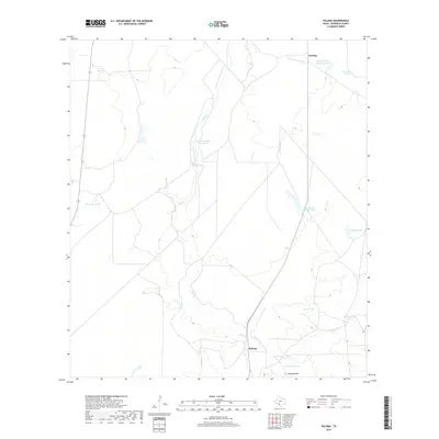
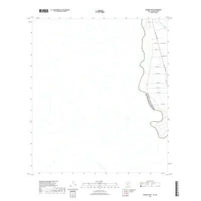
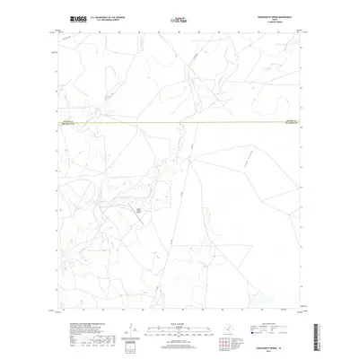
1957 Map of Botella Creek
USGS Topo · Published 1957About this map
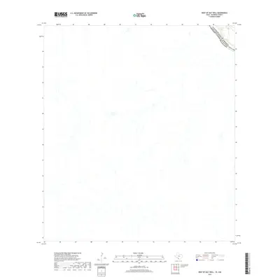
San Ambrosia Creek and Botella Creek wind through this stretch of South Texas, defining a landscape shaped by intermittent water sources and ranching life. Revised by the 8th Engineers during the mobilization of the 1940s and published as a civil edition in 1957, the map shows a specialized system of artificial water catchments like English Tank, Indio Tank, and Palo Blanco Tank that were essential for livestock in the arid brush country along the Maverick and Dimmit County line. Family ranching legacies are anchored at sites such as Hamilton Ranch, San Pedro Ranch, and Tovar Ranch. This survey captures the rural infrastructure of the mid-twentieth century, including the numerous water tanks and scattered ranch complexes that supported the local cattle industry well before modern development altered the remote boundary lands.
Find a feature on this map
28 named features on this map. Tap any name to fly to it.
Don’t see what you’re looking for? This feature index may not catch every label — zoom into the map to look around manually.
Map Details
Editions of this 1957 Botella Creek Map
This is the sole edition of this map. No revisions or reprints were ever made.
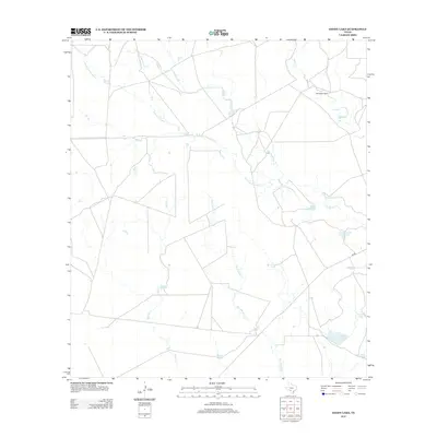
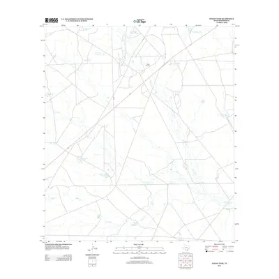
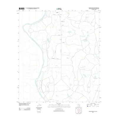
Historical Maps of Maverick County Through Time
163 maps found

1940 Chacon Creek
Maverick County, TX

1940 Cometa
Maverick County, TX

1940 Paloma
Maverick County, TX

1941 Botella Creek
Maverick County, TX
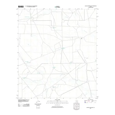
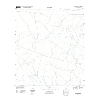
1957 Botella Creek
Maverick County, TX

1957 Indio Creek
Maverick County, TX

1974 Chacon Creek NW
Maverick County, TX

1974 Chacon Creek SW
Maverick County, TX

1974 Deadmans Hill
Maverick County, TX

1974 Goofy Lake
Maverick County, TX

1974 Imperialist Tank
Maverick County, TX

1974 Indian Tank
Maverick County, TX

1974 Paloma
Maverick County, TX

1974 Peloncillo Peak
Maverick County, TX

1974 Quemado SE
Maverick County, TX

1974 Sacatosa Tank
Maverick County, TX

1974 Trosado Tank
Maverick County, TX

1978 Tequesquite Spring
Maverick County, TX

1979 Quemado West
Maverick County, TX

1979 Tequesquite Creek SW
Maverick County, TX

1982 Eagle Pass NE
Maverick County, TX

1982 Farias Ranch
Maverick County, TX

1982 Indio Tank
Maverick County, TX

1982 Tovar Creek East
Maverick County, TX

1983 Eagle Pass East
Maverick County, TX

1983 Eagle Pass SW
Maverick County, TX

1983 Eagle Pass West
Maverick County, TX

1983 Indio Creek
Maverick County, TX

1983 Salt Well
Maverick County, TX

1983 Tovar Creek West
Maverick County, TX

1983 West of Salt Well
Maverick County, TX

1985 San Ambrosia Creek
Maverick County, TX

1993 San Ambrosia Creek
Maverick County, TX
2010 Chacon Creek NW
Maverick County, TX
2010 Chacon Creek SW
Maverick County, TX
2010 Deadmans Hill
Maverick County, TX
2010 Eagle Pass East
Maverick County, TX
2010 Eagle Pass NE
Maverick County, TX
2010 Eagle Pass SW
Maverick County, TX
2010 Eagle Pass West
Maverick County, TX
2010 Farias Ranch
Maverick County, TX
2010 Goofy Lake
Maverick County, TX
2010 Imperialist Tank
Maverick County, TX
2010 Indian Tank
Maverick County, TX
2010 Indio Creek
Maverick County, TX
2010 Indio Tank
Maverick County, TX
2010 Paloma
Maverick County, TX
2010 Peloncillo Peak
Maverick County, TX
2010 Quemado East
Maverick County, TX
2010 Quemado SE
Maverick County, TX
2010 Quemado West
Maverick County, TX
2010 Sacatosa Tank
Maverick County, TX
2010 Salt Well
Maverick County, TX
2010 Tequesquite Creek SW
Maverick County, TX
2010 Tequesquite Spring
Maverick County, TX
2010 Tovar Creek East
Maverick County, TX
2010 Tovar Creek West
Maverick County, TX
2010 Trosado Tank
Maverick County, TX
2010 West of Salt Well
Maverick County, TX

2012 Chacon Creek NW
Maverick County, TX
2012 Chacon Creek SW
Maverick County, TX
2012 Deadmans Hill
Maverick County, TX
2012 Eagle Pass East
Maverick County, TX
2012 Eagle Pass NE
Maverick County, TX
2012 Eagle Pass SW
Maverick County, TX
2012 Eagle Pass West
Maverick County, TX
2012 Farias Ranch
Maverick County, TX
2012 Goofy Lake
Maverick County, TX
2012 Indian Tank
Maverick County, TX
2012 Indio Creek
Maverick County, TX
2012 Indio Tank
Maverick County, TX
2012 Paloma
Maverick County, TX
2012 Quemado East
Maverick County, TX
2012 Quemado SE
Maverick County, TX
2012 Quemado West
Maverick County, TX
2012 Sacatosa Tank
Maverick County, TX
2012 Salt Well
Maverick County, TX

2012 Tovar Creek East
Maverick County, TX
2012 Tovar Creek West
Maverick County, TX
2012 Trosado Tank
Maverick County, TX
2012 West of Salt Well
Maverick County, TX
2013 Imperialist Tank
Maverick County, TX
2013 Peloncillo Peak
Maverick County, TX
2013 Tequesquite Creek SW
Maverick County, TX
2013 Tequesquite Spring
Maverick County, TX
2016 Chacon Creek NW
Maverick County, TX
2016 Chacon Creek SW
Maverick County, TX
2016 Deadmans Hill
Maverick County, TX
2016 Eagle Pass East
Maverick County, TX
2016 Eagle Pass NE
Maverick County, TX
2016 Eagle Pass SW
Maverick County, TX
2016 Eagle Pass West
Maverick County, TX
2016 Farias Ranch
Maverick County, TX
2016 Goofy Lake
Maverick County, TX
2016 Imperialist Tank
Maverick County, TX
2016 Indian Tank
Maverick County, TX
2016 Indio Creek
Maverick County, TX
2016 Indio Tank
Maverick County, TX
2016 Paloma
Maverick County, TX
2016 Peloncillo Peak
Maverick County, TX
2016 Quemado East
Maverick County, TX
2016 Quemado SE
Maverick County, TX
2016 Quemado West
Maverick County, TX
2016 Sacatosa Tank
Maverick County, TX
2016 Salt Well
Maverick County, TX

2016 Tequesquite Creek SW
Maverick County, TX
2016 Tequesquite Spring
Maverick County, TX
2016 Tovar Creek East
Maverick County, TX
2016 Tovar Creek West
Maverick County, TX
2016 Trosado Tank
Maverick County, TX
2016 West of Salt Well
Maverick County, TX
2019 Chacon Creek NW
Maverick County, TX
2019 Chacon Creek SW
Maverick County, TX
2019 Deadmans Hill
Maverick County, TX
2019 Eagle Pass East
Maverick County, TX
2019 Eagle Pass NE
Maverick County, TX
2019 Eagle Pass SW
Maverick County, TX
2019 Eagle Pass West
Maverick County, TX
2019 Farias Ranch
Maverick County, TX
2019 Goofy Lake
Maverick County, TX
2019 Imperialist Tank
Maverick County, TX
2019 Indian Tank
Maverick County, TX
2019 Indio Creek
Maverick County, TX
2019 Indio Tank
Maverick County, TX
2019 Paloma
Maverick County, TX
2019 Peloncillo Peak
Maverick County, TX
2019 Quemado East
Maverick County, TX
2019 Quemado SE
Maverick County, TX
2019 Quemado West
Maverick County, TX
2019 Sacatosa Tank
Maverick County, TX
2019 Salt Well
Maverick County, TX
2019 Tequesquite Creek SW
Maverick County, TX
2019 Tequesquite Spring
Maverick County, TX
2019 Tovar Creek East
Maverick County, TX
2019 Tovar Creek West
Maverick County, TX
2019 Trosado Tank
Maverick County, TX
2019 West of Salt Well
Maverick County, TX

2022 Chacon Creek NW
Maverick County, TX

2022 Chacon Creek SW
Maverick County, TX

2022 Deadmans Hill
Maverick County, TX

2022 Eagle Pass East
Maverick County, TX

2022 Eagle Pass NE
Maverick County, TX

2022 Eagle Pass SW
Maverick County, TX

2022 Eagle Pass West
Maverick County, TX

2022 Farias Ranch
Maverick County, TX

2022 Goofy Lake
Maverick County, TX

2022 Imperialist Tank
Maverick County, TX

2022 Indian Tank
Maverick County, TX

2022 Indio Creek
Maverick County, TX

2022 Indio Tank
Maverick County, TX

2022 Paloma
Maverick County, TX

2022 Peloncillo Peak
Maverick County, TX

2022 Quemado East
Maverick County, TX

2022 Quemado SE
Maverick County, TX

2022 Quemado West
Maverick County, TX

2022 Sacatosa Tank
Maverick County, TX

2022 Salt Well
Maverick County, TX

2022 Tequesquite Creek SW
Maverick County, TX

2022 Tequesquite Spring
Maverick County, TX

2022 Tovar Creek East
Maverick County, TX

2022 Tovar Creek West
Maverick County, TX

2022 Trosado Tank
Maverick County, TX

2022 West of Salt Well
Maverick County, TX