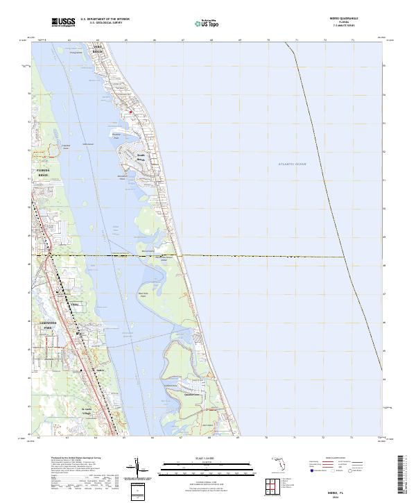
2024 Map of Indrio
USGS Topo · Published 2024About this map
St. Lucie Village and the residential clusters of Indrio and Viking anchor the mainland shore along the western edge of the Indian River lagoon. This coastal landscape is defined by the narrow barrier system of North Hutchinson Island, where developments like Queens Cove and South Beach sit between the Atlantic Ocean and the intricate coves of the Intracoastal Waterway. The map details a complex aqueous environment of named points and pockets, including Porpoise Point, Starvation Cove, and Hells Pocket. Inland, the transition from managed landscapes like Hillcrest Memorial Gardens to the residential streets of Lakewood Park reflects the modern expansion of the Vero Beach vicinity. Recreational and ecological corridors are well-documented, specifically the Florida Circumavigational Paddling Trl and Indian River Blueway Trl, which navigate the various islands and cuts such as Negro Cut and Garfield Cut.
Find a feature on this map
93 named features on this map. Tap any name to fly to it.
Don’t see what you’re looking for? This feature index may not catch every label — zoom into the map to look around manually.
Map Details
Editions of this 2024 Indrio Map
This is the sole edition of this map. No revisions or reprints were ever made.
Other maps of this area

1948 · Riomar
USGS Topo · 1:24,000

1948 · Indrio
USGS Topo · 1:24,000

1949 · Fort Pierce
USGS Topo · 1:24,000

1949 · Vero Beach
USGS Topo · 1:24,000

1949 · Oslo
USGS Topo · 1:24,000

1949 · Fort Pierce NW
USGS Topo · 1:24,000

1950 · Riomar
USGS Topo · 1:24,000

1950 · Fort Pierce
USGS Topo · 1:24,000

1950 · Fort Pierce NW
USGS Topo · 1:24,000

1950 · Oslo
USGS Topo · 1:24,000