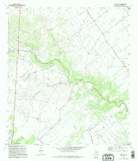
1995 Map of Inez NW
USGS Topo · Published 1995About this map
The coastal plains of Victoria County are defined here by the winding course of Garcitas Creek and its southern tributary, Willow Creek. This landscape, documented through aerial photography and field checking into the early 1990s, reveals a rural territory heavily influenced by the petroleum industry. Numerous Gas Wells, Oil Well sites, and an extensive network of pipelines crisscross the cattle-country terrain, marked by scattered Corrals.
Find a feature on this map
17 named features on this map. Tap any name to fly to it.
Don’t see what you’re looking for? This feature index may not catch every label — zoom into the map to look around manually.
Map Details
Editions of this 1995 Inez NW Map
This is the sole edition of this map. No revisions or reprints were ever made.
Other maps of this area

1951 · Inez NW
USGS Topo · 1:24,000

1951 · Inez
USGS Topo · 1:24,000

1952 · Marcado Creek
USGS Topo · 1:24,000

1952 · Victoria East
USGS Topo · 1:24,000

1953 · Beeville
USGS Topo · 1:250,000

1953 · Seguin
USGS Topo · 1:250,000

1956 · Beeville
USGS Topo · 1:250,000

1958 · Seguin
USGS Topo · 1:250,000

1960 · Beeville
USGS Topo · 1:250,000

1963 · Fordtran
USGS Topo · 1:24,000