2022 Map of Inez
USGS Topo · Published 2022About this map
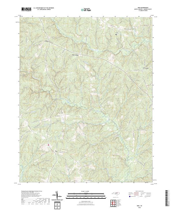
Inez and Liberia anchor this section of Warren County, where a complex network of creeks and branches defines the local geography. The landscape is deeply etched by waterways like Fishing Cr, Reedy Cr, and Shocco Cr, suggesting a long history of agricultural drainage and property division based on natural boundaries. Rural life is evidenced by the numerous family-named roads and landmarks, including Lovely Hill Cem, which serves as a significant genealogical point of interest for the area. Smaller communities such as Marmaduke and Grove Hill are connected by a dense grid of secondary routes like Baltimore Church Rd and Dillard Rd, reflecting a dispersed settlement pattern characteristic of North Carolina's coastal plain. The presence of features such as Wolfpit Br and Gum Pond Br points to the specific localized nomenclature given to the many tributaries flowing through these woods and fields.
Find a feature on this map
54 named features on this map. Tap any name to fly to it.
Don’t see what you’re looking for? This feature index may not catch every label — zoom into the map to look around manually.
Map Details
Editions of this 2022 Inez Map
This is the sole edition of this map. No revisions or reprints were ever made.
Historical Maps of Inez Through Time
4 maps found