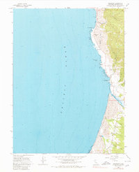
1966 Map of Inglenook
USGS Topo · Published 1980About this map
Coastal bluffs and rugged shoreline settlements define this stretch of Mendocino County during the mid-1960s. Small hamlets like Kibesillah and Newport are perched above the Pacific Ocean, reflecting a landscape shaped by early maritime commerce and ranching before the modernization of the coastal corridor. The inland topography is marked by deep gulches such as Chadbourne Gulch and Abalobadiah Creek, which cut through the uplifted marine terraces toward the sea.
Find a feature on this map
23 named features on this map. Tap any name to fly to it.
Don’t see what you’re looking for? This feature index may not catch every label — zoom into the map to look around manually.
Map Details
Editions of this 1966 Inglenook Map
4 editions found
Other maps of this area

1920 · Glenblair
USGS Topo · 1:62,500

1920 · Fort Bragg
USGS Topo · 1:62,500

1921 · Westport
USGS Topo · 1:62,500

1921 · Branscomb
USGS Topo · 1:62,500

1943 · Glenblair
USGS Topo · 1:62,500

1943 · Fort Bragg
USGS Topo · 1:62,500

1950 · Cape Vizcaino
USGS Topo · 1:62,500

1951 · Cape Vizcaino
USGS Topo · 1:62,500

1951 · Branscomb
USGS Topo · 1:62,500

1957 · Ukiah
USGS Topo · 1:250,000