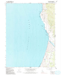
1966 Map of Inglenook
USGS Topo · Published 1992About this map
Kibesillah and the coastal bluffs of Mendocino County define this 1960s survey, capturing a landscape where small seaside settlements cling to the edge of the Pacific Ocean. The geography is shaped by numerous coastal drainages, including Chadbourne Gulch, Kibesillah Creek, and Seaside Creek, which cut through the uplifted marine terraces toward the sea. To the south, the broad estuary of the Ten Mile River meets the coast, bordered by an extensive field of Sand Dunes and the secluded Sandhill Lake.
Find a feature on this map
26 named features on this map. Tap any name to fly to it.
Don’t see what you’re looking for? This feature index may not catch every label — zoom into the map to look around manually.
Map Details
Editions of this 1966 Inglenook Map
4 editions found
Other maps of this area

1920 · Glenblair
USGS Topo · 1:62,500

1920 · Fort Bragg
USGS Topo · 1:62,500

1921 · Westport
USGS Topo · 1:62,500

1921 · Branscomb
USGS Topo · 1:62,500

1943 · Glenblair
USGS Topo · 1:62,500

1943 · Fort Bragg
USGS Topo · 1:62,500

1950 · Cape Vizcaino
USGS Topo · 1:62,500

1951 · Cape Vizcaino
USGS Topo · 1:62,500

1951 · Branscomb
USGS Topo · 1:62,500

1957 · Ukiah
USGS Topo · 1:250,000