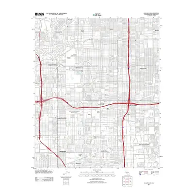
2012 Map of Inglewood
USGS Topo · Published 2012About this map
Inglewood and the surrounding urban corridors of Los Angeles County appear here in a dense network of residential streets and industrial zones. The landscape is heavily defined by its aviation and academic infrastructure, anchored by the Jack Northrop Field/Hawthorne Municipal Airport and several major educational centers including Pepperdine College, El Camino College, and Middle College High School. Historical burial grounds like Inglewood Park Cem and Lincoln Memorial Park provide significant genealogical reference points amid the grid. Hydrological features are largely engineered, with the Dominguez Channel and Compton Cr cutting through neighborhoods like Gardena and Lawndale. The map also captures specialized land uses such as the Childrens Baptist Home of Southern California and the Chester Washington Golf Course, reflecting the developed character of the South Bay area.
Find a feature on this map
39 named features on this map. Tap any name to fly to it.
Don’t see what you’re looking for? This feature index may not catch every label — zoom into the map to look around manually.
Map Details
Editions of this 2012 Inglewood Map
This is the sole edition of this map. No revisions or reprints were ever made.
Other maps of this area

1894 · Los Angeles
USGS Topo · 1:62,500

1896 · Pasadena
USGS Topo · 1:62,500

1896 · Redondo
USGS Topo · 1:62,500

1896 · Santa Monica
USGS Topo · 1:62,500

1896 · Downey
USGS Topo · 1:62,500

1898 · Santa Monica
USGS Topo · 1:62,500

1899 · Downey
USGS Topo · 1:62,500

1900 · Pasadena
USGS Topo · 1:62,500

1900 · Los Angeles
USGS Topo · 1:62,500

1901 · Southern California Sheet No. 1
USGS Topo · 1:250,000