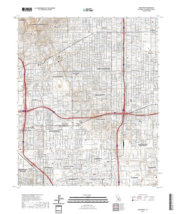
2021 Map of Inglewood
USGS Topo · Published 2021About this map
Baldwin Hills and the Rosecrans Hills define the topography of this densely populated portion of Los Angeles County. This contemporary survey captures the transition from the high-ground residential areas of View Park-Windsor Hills and Ladera Heights to the industrial and municipal hubs of Hawthorne and Inglewood. The map provides significant detail for genealogists and local historians, showing the vast grounds of the Inglewood Park Cem, including the Mausoleum of the Golden West, and the Lincoln Memorial Park further southeast.
Find a feature on this map
338 named features on this map. Tap any name to fly to it.
Don’t see what you’re looking for? This feature index may not catch every label — zoom into the map to look around manually.
Map Details
Editions of this 2021 Inglewood Map
This is the sole edition of this map. No revisions or reprints were ever made.
Other maps of this area

1894 · Los Angeles
USGS Topo · 1:62,500

1896 · Pasadena
USGS Topo · 1:62,500

1896 · Redondo
USGS Topo · 1:62,500

1896 · Santa Monica
USGS Topo · 1:62,500

1896 · Downey
USGS Topo · 1:62,500

1898 · Santa Monica
USGS Topo · 1:62,500

1899 · Downey
USGS Topo · 1:62,500

1900 · Pasadena
USGS Topo · 1:62,500

1900 · Los Angeles
USGS Topo · 1:62,500

1901 · Southern California Sheet No. 1
USGS Topo · 1:250,000