
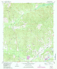
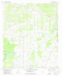
1980 Map of Ingram
USGS Topo · Published 1980About this map
Ingram and the surrounding Hale County landscape appear here as a patchwork of timberland and rural congregation points. The northeastern corner is dominated by the Talladega National Forest, while the rest of the area is defined by a high density of country churches and family burial grounds. These small community hubs, such as Macedonia Ch and Morning Star Ch, are often paired with their own namesake cemeteries, including Macedonia Ch Cem and Morning Star Ch Cem.
Find a feature on this map
30 named features on this map. Tap any name to fly to it.
Don’t see what you’re looking for? This feature index may not catch every label — zoom into the map to look around manually.
Map Details
Editions of this 1980 Ingram Map
2 editions found
Other maps of this area

1953 · Montgomery
USGS Topo · 1:250,000

1956 · Montgomery
USGS Topo · 1:250,000

1957 · Montgomery
USGS Topo · 1:250,000

1979 · Morgan Springs
USGS Topo · 1:24,000

1979 · Greensboro
USGS Topo · 1:24,000

1980 · Payne Lake
USGS Topo · 1:24,000
1980 · Moundville West
USGS Topo · 1:24,000
1980 · Sawyerville
USGS Topo · 1:24,000
1980 · Hogglesville
USGS Topo · 1:24,000
1980 · Melton
USGS Topo · 1:24,000