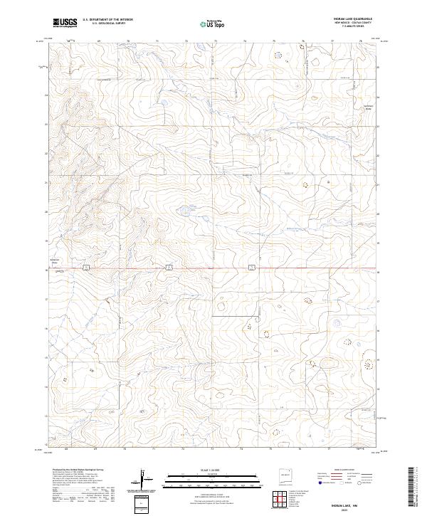
2023 Map of Ingram Lake
USGS Topo · Published 2023About this map
Ingram Lake sits at the heart of this high-plains landscape in Colfax County, where drainage patterns define the local geography. The area is characterized by a network of seasonal watercourses, including the wide Sand Arroyo which traverses the northern townships and Wilson Arroyo further south. A notable landmark in the northeast is Sombrero Butte, rising above the surrounding terrain near the junction of several rural routes.
Find a feature on this map
25 named features on this map. Tap any name to fly to it.
Don’t see what you’re looking for? This feature index may not catch every label — zoom into the map to look around manually.
Map Details
Editions of this 2023 Ingram Lake Map
This is the sole edition of this map. No revisions or reprints were ever made.
Other maps of this area

1954 · Raton
USGS Topo · 1:250,000

1958 · Raton
USGS Topo · 1:250,000

1965 · Sauble Circle Dot Ranch
USGS Topo · 1:24,000

1965 · Abbott
USGS Topo · 1:24,000

1971 · Abbott Lake
USGS Topo · 1:24,000

1974 · Point Of Rocks Mesa
USGS Topo · 1:24,000

1974 · Farley
USGS Topo · 1:24,000
1974 · Lawrence Arroyo
USGS Topo · 1:24,000

1974 · Spear Hills
USGS Topo · 1:24,000
1974 · Divine Lake
USGS Topo · 1:24,000