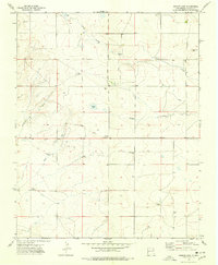
1974 Map of Ingram Lake
USGS Topo · Published 1978About this map
Ingram Lake and the prominent topographic landmark known as Point of Rocks define this high-plains landscape in Colfax County during the mid-1970s. The area is characterized by a sparse but vital network of water sources, indicated by the numerous family-named wells that serve as primary landmarks across the rangeland. These include Hatch Well, Ward Well, Fisher Well, Ottos Wells, Spencer Well, Newton Well, Kidder Well, and Wood Well.
Find a feature on this map
23 named features on this map. Tap any name to fly to it.
Don’t see what you’re looking for? This feature index may not catch every label — zoom into the map to look around manually.
Map Details
Editions of this 1974 Ingram Lake Map
This is the sole edition of this map. No revisions or reprints were ever made.
Other maps of this area

1954 · Raton
USGS Topo · 1:250,000

1958 · Raton
USGS Topo · 1:250,000

1965 · Sauble Circle Dot Ranch
USGS Topo · 1:24,000

1965 · Abbott
USGS Topo · 1:24,000

1971 · Abbott Lake
USGS Topo · 1:24,000

1974 · Point Of Rocks Mesa
USGS Topo · 1:24,000

1974 · Farley
USGS Topo · 1:24,000
1974 · Lawrence Arroyo
USGS Topo · 1:24,000

1974 · Spear Hills
USGS Topo · 1:24,000
1974 · Divine Lake
USGS Topo · 1:24,000