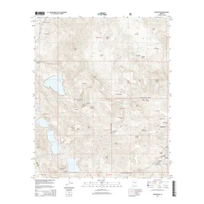
2014 Map of Inspiration
USGS Topo · Published 2014About this map
Miami and the neighboring settlement of Inspiration anchor the southeastern corner of this Arizona landscape, positioned where the industrial infrastructure of the copper corridor meets the expansive Tonto National Forest. The map reveals a complex system of water management and topography essential to the region, including numerous tanks and springs such as Continental Tank, Eastwater Spring, and Bohme Spring. Peaks and basins dominate the interior, with named landmarks like Porphyry Mtn, Sleeping Beauty Peak, and Barnes Peak providing a rugged verticality to the terrain.
Find a feature on this map
102 named features on this map. Tap any name to fly to it.
Don’t see what you’re looking for? This feature index may not catch every label — zoom into the map to look around manually.
Map Details
Editions of this 2014 Inspiration Map
This is the sole edition of this map. No revisions or reprints were ever made.
Other maps of this area

1900 · Florence
USGS Topo · 1:125,000

1901 · Globe
USGS Topo · 1:62,500

1902 · Globe
USGS Topo · 1:62,500

1902 · Florence
USGS Topo · 1:125,000

1907 · Roosevelt
USGS Topo · 1:125,000

1909 · Four Peaks
USGS Topo · 1:125,000

1912 · Roosevelt
USGS Topo · 1:125,000

1922 · Chrysotile
USGS Topo · 1:125,000

1945 · Globe
USGS Topo · 1:24,000

1945 · Inspiration
USGS Topo · 1:24,000