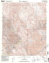
2004 Map of Inspiration
USGS Topo · Published 2007About this map
Large-scale industrial copper extraction defines the landscape of the Tonto National Forest in this central Arizona survey. The map centers on the massive Pinto Valley Open Pit Mine and the complex infrastructure of the Inspiration district, including the Inspiration Main Shafts, the Castle Dome Concentrator, and a sprawling Leaching Plant. The sheer volume of material moved is evident in the vast Tailings Pond systems that fill the canyons west of the mining pits.
Find a feature on this map
79 named features on this map. Tap any name to fly to it.
Don’t see what you’re looking for? This feature index may not catch every label — zoom into the map to look around manually.
Map Details
Editions of this 2004 Inspiration Map
This is the sole edition of this map. No revisions or reprints were ever made.
Other maps of this area

1900 · Florence
USGS Topo · 1:125,000

1901 · Globe
USGS Topo · 1:62,500

1902 · Globe
USGS Topo · 1:62,500

1902 · Florence
USGS Topo · 1:125,000

1907 · Roosevelt
USGS Topo · 1:125,000

1909 · Four Peaks
USGS Topo · 1:125,000

1912 · Roosevelt
USGS Topo · 1:125,000

1922 · Chrysotile
USGS Topo · 1:125,000

1945 · Globe
USGS Topo · 1:24,000

1945 · Inspiration
USGS Topo · 1:24,000