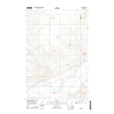
2014 Map of Intake
USGS Topo · Published 2014About this map
The Yellowstone River anchors this landscape in eastern Montana, carving a wide path through Dawson and Richland counties. Along its northern banks, the small settlement of Intake serves as a focal point near the head of the Main Canal, a vital piece of water infrastructure that supports agriculture in this semi-arid region. The map reveals the intricate drainage patterns of the surrounding plains, where seasonal waterways like War Dance Cr, Linden Cr, and Thirteenmile Cr have eroded the terrain into deep draws such as Black Tail Coulee.
Find a feature on this map
31 named features on this map. Tap any name to fly to it.
Don’t see what you’re looking for? This feature index may not catch every label — zoom into the map to look around manually.
Map Details
Editions of this 2014 Intake Map
This is the sole edition of this map. No revisions or reprints were ever made.
Other maps of this area

1909 · Glendive
USGS Topo · 1:250,000

1954 · Glendive
USGS Topo · 1:250,000

1957 · Glendive
USGS Topo · 1:250,000

1958 · Glendive
USGS Topo · 1:250,000

1966 · Kolberg Ranch
USGS Topo · 1:24,000

1966 · Savage SW
USGS Topo · 1:24,000

1966 · Intake
USGS Topo · 1:24,000

1966 · Knife River Mine
USGS Topo · 1:24,000

1966 · Intake NW
USGS Topo · 1:24,000

1966 · Allard Ranch
USGS Topo · 1:24,000