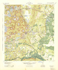
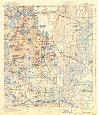
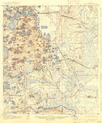
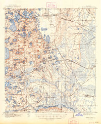
1916 Map of Interlachen
USGS Topo · Published 1937About this map
Interlachen and its surrounding lake district appear here in a landscape defined by citrus groves and early rail transit before the mid-century expansion of modern infrastructure. This 1915 survey shows a dense concentration of water bodies, from Lake Grandin to the smaller Lady Slipper Lake, illustrating the unique hydrology of the Oklawaha Valley. Settlement patterns are tightly tied to the Atlantic Coast Line and the Georgia And Southern Road, which served established communities like Florahome, Melrose, and the sawmill town of Rodman. Along the southern boundary, the transition into the Ocala National Forest is marked by the rugged Oklawaha Scrub. Local life at this time centered around rural landmarks like Congo School and river crossings such as Jordan's Ferry and Cedar Landing Ferry, which provided essential transit across the Oklawaha River prior to widespread bridging.
Find a feature on this map
119 named features on this map. Tap any name to fly to it.
Don’t see what you’re looking for? This feature index may not catch every label — zoom into the map to look around manually.
Map Details
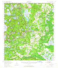
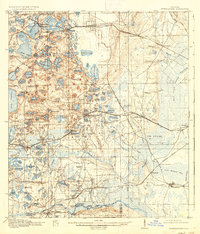
Editions of this 1916 Interlachen Map
6 editions found

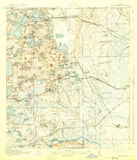
Historical Maps of Interlachen Through Time
4 maps found