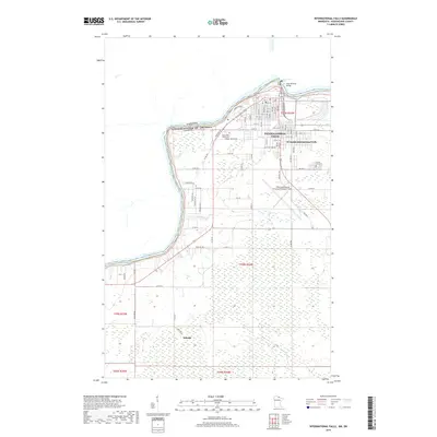
2019 Map of International Falls
USGS Topo · Published 2019About this map
Rainy River defines the international boundary on this 2019 survey, winding past the industrial and urban center of International Falls. The map details the transition from the structured street grids of the city and South International Falls to the sprawling wetlands and timberlands of the south. Near the river’s edge, Koochiching Falls and the Rainy River Community College campus anchor the local community. Further south, the landscape is marked by the expansive Falls International Airport-Einarson Field and the small settlement of Nakoda along the Town Rd 204. Local history and genealogy are supported by the inclusion of Forest Hill Cem and a dense network of township roads such as Co Rd 152 and Baron Rd that navigate the low-lying reaches of Cripple Cr.
Find a feature on this map
62 named features on this map. Tap any name to fly to it.
Don’t see what you’re looking for? This feature index may not catch every label — zoom into the map to look around manually.
Map Details
Editions of this 2019 International Falls Map
This is the sole edition of this map. No revisions or reprints were ever made.
Other maps of this area

1919 · Pelland
USGS Topo · 1:62,500

1919 · Happy Land
USGS Topo · 1:62,500

1919 · International Falls
USGS Topo · 1:62,500

1954 · International Falls
USGS Topo · 1:250,000

1957 · International Falls
USGS Topo · 1:250,000

1958 · International Falls
USGS Topo · 1:250,000

1963 · Ranier
USGS Topo · 1:24,000

1969 · Ericsburg NW
USGS Topo · 1:24,000

1969 · Ericsburg
USGS Topo · 1:24,000

1969 · Ranier
USGS Topo · 1:24,000