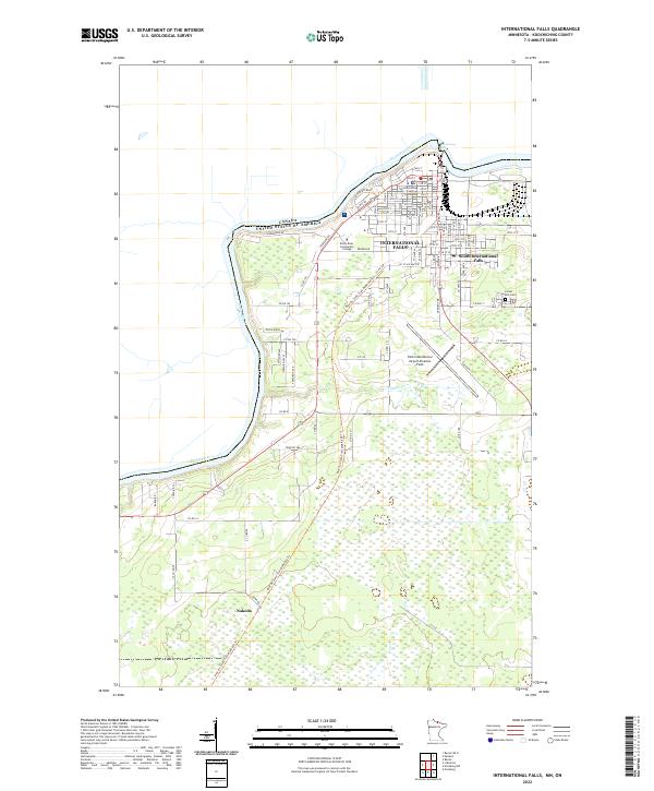
2022 Map of International Falls
USGS Topo · Published 2022About this map
The Rainy River forms a prominent international boundary between the United States and Canada at this border crossing in Koochiching County. The urban center of International Falls dominates the northern portion of the map, featuring the Koochiching County Courthouse and the nearby South International Falls area. The landscape transitions from the developed streets of the city to the expansive wetlands and wooded areas to the south, where the small settlement of Nakoda sits along the southern rail corridor.
Find a feature on this map
41 named features on this map. Tap any name to fly to it.
Don’t see what you’re looking for? This feature index may not catch every label — zoom into the map to look around manually.
Map Details
Editions of this 2022 International Falls Map
This is the sole edition of this map. No revisions or reprints were ever made.
Other maps of this area

1919 · Pelland
USGS Topo · 1:62,500

1919 · Happy Land
USGS Topo · 1:62,500

1919 · International Falls
USGS Topo · 1:62,500

1954 · International Falls
USGS Topo · 1:250,000

1957 · International Falls
USGS Topo · 1:250,000

1958 · International Falls
USGS Topo · 1:250,000

1963 · Ranier
USGS Topo · 1:24,000

1969 · Ericsburg NW
USGS Topo · 1:24,000

1969 · Ericsburg
USGS Topo · 1:24,000

1969 · Ranier
USGS Topo · 1:24,000