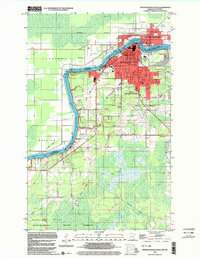
1999 Map of International Falls
USGS Topo · Published 2003About this map
The Rainy River defines this borderland landscape, separating International Falls and South International Falls from Fort Frances in Ontario. The urban grid is dense with civic infrastructure, including the Museum, Library, and US Customs station at the international bridge. Settlement patterns extend south toward the rail junction at Nakoda, where the Canadian National tracks meet an Old Railroad Grade. To the south and west, the landscape transitions into the wooded expanse of the Koochiching State Forest. Cultural sites like Forest Hill Cem, Falls Ch, and the Holler Sch provide significant landmarks for local history. The presence of an Old Winter Trail and Winter Trail cutting through the forest and wetlands reflects the seasonal nature of transportation in this northern climate before modern road networks were fully established.
Find a feature on this map
32 named features on this map. Tap any name to fly to it.
Don’t see what you’re looking for? This feature index may not catch every label — zoom into the map to look around manually.
Map Details
Editions of this 1999 International Falls Map
This is the sole edition of this map. No revisions or reprints were ever made.
Other maps of this area

1919 · Pelland
USGS Topo · 1:62,500

1919 · Happy Land
USGS Topo · 1:62,500

1919 · International Falls
USGS Topo · 1:62,500

1954 · International Falls
USGS Topo · 1:250,000

1957 · International Falls
USGS Topo · 1:250,000

1958 · International Falls
USGS Topo · 1:250,000

1963 · Ranier
USGS Topo · 1:24,000

1969 · Ericsburg NW
USGS Topo · 1:24,000

1969 · Ericsburg
USGS Topo · 1:24,000

1969 · Ranier
USGS Topo · 1:24,000