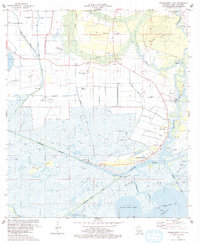
1975 Map of Intracoastal City
USGS Topo · Published 1978About this map
The settlement of Intracoastal City stands as a vital hub for marine and industrial activity at the junction of the Intracoastal Waterway and the Vermilion River. This mid-1970s landscape is defined by its extensive network of navigation channels and drainage infrastructure, including the Miller Island Canal, Freshwater Bayou Canal, and the Vermilion Lock. The map reveals the critical importance of the oil and gas industry to this coastal region, marked by numerous heliports and gas wells scattered across the marshy terrain and gas fields.
Find a feature on this map
38 named features on this map. Tap any name to fly to it.
Don’t see what you’re looking for? This feature index may not catch every label — zoom into the map to look around manually.
Map Details
Editions of this 1975 Intracoastal City Map
This is the sole edition of this map. No revisions or reprints were ever made.
Other maps of this area

1932 · Abbeville SW
USGS Topo · 1:31,680

1932 · Abbeville SE
USGS Topo · 1:31,680

1932 · Abbeville NE
USGS Topo · 1:31,680

1932 · Abbeville NW
USGS Topo · 1:31,680

1945 · Pecan Island NE
USGS Topo · 1:31,680

1946 · Schooner Bayou SE
USGS Topo · 1:31,680

1946 · Redfish Point NE
USGS Topo · 1:31,680

1946 · Schooner Bayou NE
USGS Topo · 1:31,680

1946 · Redfish Point NW
USGS Topo · 1:31,680

1951 · Pecan Island
USGS Topo · 1:62,500