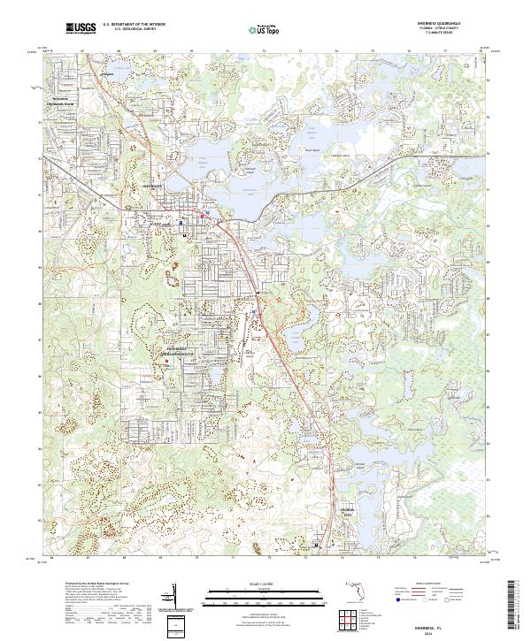
2024 Map of Inverness
USGS Topo · Published 2024About this map
Inverness serves as the focal point of this Citrus County landscape, centered around the Citrus County Courthouse and the sprawling waters of Tsala Apopka Lake. The map reveals a complex aquatic geography defined by numerous named islands such as Gospel Island and Scout Island, intertwined with the Henderson Lake and Magnolia Lake systems. This modern survey reflects the significant residential expansion of Inverness Highlands North and Inverness Highlands South, which contrast with the preserved natural areas of Fort Cooper State Park. For those interested in regional recreation and transportation, the map clearly traces the Withlacoochee State Trl and the Florida National Scenic Trl, alongside the Inverness Airport and local landmarks like the Withlacoochee Technical College.
Find a feature on this map
43 named features on this map. Tap any name to fly to it.
Don’t see what you’re looking for? This feature index may not catch every label — zoom into the map to look around manually.
Map Details
Editions of this 2024 Inverness Map
This is the sole edition of this map. No revisions or reprints were ever made.
Other maps of this area

1893 · Panasoffkee
USGS Topo · 1:62,500

1895 · Tsala Apopka
USGS Topo · 1:62,500

1895 · Panasoffkee
USGS Topo · 1:62,500

1954 · Lecanto
USGS Topo · 1:24,000

1954 · Holder
USGS Topo · 1:24,000

1954 · Brooksville NW
USGS Topo · 1:24,000

1954 · Nobleton
USGS Topo · 1:24,000

1954 · Tsala Apopka NE
USGS Topo · 1:24,000

1954 · Inverness
USGS Topo · 1:24,000

1954 · Inverness
USGS Topo · 1:62,500