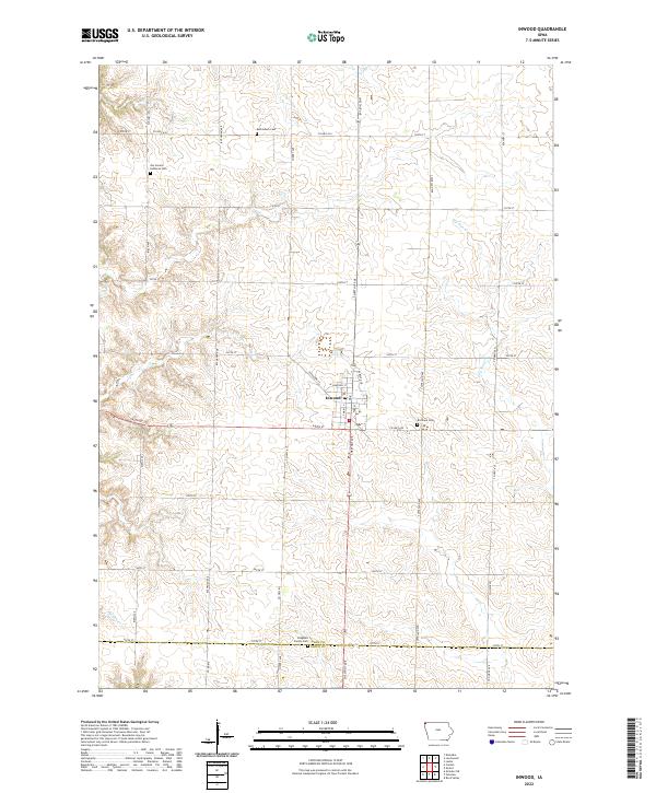
2022 Map of Inwood
USGS Topo · Published 2022About this map
The town of Inwood serves as the focal point of this Northwest Iowa landscape, situated near the intersection of Co Hwy A52 and Co Hwy K12. The area is characterized by a dense grid of rural roads and established agricultural sections across the Lyon Co Sioux Co border. A significant concentration of community heritage is preserved in the local cemeteries, including the Bethlehem Cem to the north and the Bragstad Family Cem near the southern boundary. The drainage of the land is defined by Dry Run Cr, which meanders through the eastern sections, and Nelson Cr in the southwest. The presence of Our Saviors Lutheran Cem and Richland Cem provides valuable landmarks for genealogists and local historians tracing the lineage of the township families who settled these sections.
Find a feature on this map
40 named features on this map. Tap any name to fly to it.
Don’t see what you’re looking for? This feature index may not catch every label — zoom into the map to look around manually.
Map Details
Editions of this 2022 Inwood Map
This is the sole edition of this map. No revisions or reprints were ever made.
Other maps of this area

1897 · Canton
USGS Topo · 1:125,000

1900 · Canton
USGS Topo · 1:125,000

1955 · Sioux Falls
USGS Topo · 1:250,000

1958 · Sioux Falls
USGS Topo · 1:250,000

1962 · Klondike
USGS Topo · 1:24,000

1962 · Canton
USGS Topo · 1:24,000

1968 · Alcester NE
USGS Topo · 1:24,000

1968 · Fairview
USGS Topo · 1:24,000
1968 · Rock Valley
USGS Topo · 1:24,000

1971 · Lester
USGS Topo · 1:24,000