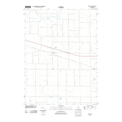
2010 Map of Inwood
USGS Topo · Published 2010About this map
Bourbon and Inwood serve as the primary population centers in this section of Marshall County, defined by a highly organized grid of rural roads and an extensive network of managed waterways. The landscape is dominated by agricultural drainage features like Daniels Ditch, Crews Ditch, and Porter Ditch, which channel water toward the Yellow River in the north and Deer Creek in the south. This managed hydrology reflects the region's intensive farming legacy. Local transportation and aviation are prominent, with the Lincoln Hwy providing a major east-west corridor alongside the Tri State Airport and Scott Airfield. For those tracing local roots, the Salem Cemetery stands as a quiet landmark between the two main settlements, while the names of the north-south roads—such as Ironwood Rd, Hawthorn Rd, and Hickory Rd—point to the native timber that once characterized this part of Indiana.
Find a feature on this map
47 named features on this map. Tap any name to fly to it.
Don’t see what you’re looking for? This feature index may not catch every label — zoom into the map to look around manually.
Map Details
Editions of this 2010 Inwood Map
This is the sole edition of this map. No revisions or reprints were ever made.
Other maps of this area

1953 · Chicago
USGS Topo · 1:250,000

1957 · Chicago
USGS Topo · 1:250,000

1957 · Inwood
USGS Topo · 1:24,000

1957 · Plymouth
USGS Topo · 1:24,000

1958 · Bremen
USGS Topo · 1:24,000

1958 · La Paz
USGS Topo · 1:24,000

1958 · Nappanee West
USGS Topo · 1:24,000

1958 · Bourbon
USGS Topo · 1:24,000

1959 · Mentone
USGS Topo · 1:24,000

1962 · Argos
USGS Topo · 1:24,000