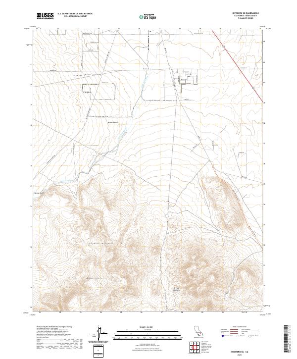
2021 Map of Inyokern SE
USGS Topo · Published 2021About this map
Indian Wells Valley and the northern reaches of the Mojave Desert dominate this 2021 landscape, illustrating the intersection of modern logistics and geological history. The terrain transitions from the alluvial floor to the complex elevations of the El Paso Mountains and the Black Hills. A significant historical footprint is visible in the form of the Abandoned Rr Bed Trl, which cuts across the eastern sector, tracing a path through the desert that once served the region's mining or transport needs. Local development is concentrated along a systematic grid of roads including Ridgecrest Blvd and Bowman Rd, while natural drainages like Little Dixie Wash and Freeman Gulch dictate the flow of the land. The presence of street names like Pumice Ave and Calsilco Ave alludes to the mineral extraction history that has long defined this part of Kern County.
Find a feature on this map
35 named features on this map. Tap any name to fly to it.
Don’t see what you’re looking for? This feature index may not catch every label — zoom into the map to look around manually.
Map Details
Editions of this 2021 Inyokern SE Map
This is the sole edition of this map. No revisions or reprints were ever made.
Other maps of this area

1903 · Randsburg
USGS Topo · 1:62,500

1911 · Randsburg
USGS Topo · 1:62,500

1912 · Randsburg
USGS Topo · 1:62,500

1915 · Searles Lake
USGS Topo · 1:250,000

1943 · Inyokern
USGS Topo · 1:62,500

1943 · Saltdale
USGS Topo · 1:62,500

1947 · Trona
USGS Topo · 1:250,000

1948 · Trona
USGS Topo · 1:250,000

1953 · Ridgecrest
USGS Topo · 1:62,500

1953 · Trona
USGS Topo · 1:250,000