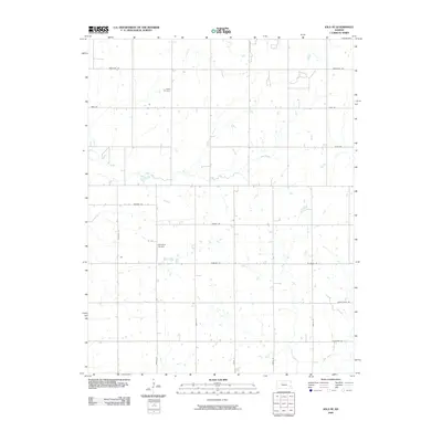
2009 Map of Iola SE
USGS Topo · Published 2009About this map
Salem Cemetery stands as a focal point for genealogical research in this rural portion of Allen County, marking a site of local heritage amidst an organized grid of section roads. The landscape is defined by the drainage patterns of Coal Creek and Slack Creek, which meander across the prairie terrain. Transportation in the early 21st century relied on a network of state-named routes, including Georgia Rd, Florida Rd, and Delaware Rd, which intersect with numbered north-south corridors like 2000th St and 2400th St. Aviation history is represented by the Croisant Airport, a private or local airstrip located near the center of the survey area. Southward, the map tracks the headwaters and tributaries of Goose Creek and Big Creek, illustrating the natural water distribution that governed historical land use and agricultural development in this Kansas township.
Find a feature on this map
21 named features on this map. Tap any name to fly to it.
Don’t see what you’re looking for? This feature index may not catch every label — zoom into the map to look around manually.
Map Details
Editions of this 2009 Iola SE Map
This is the sole edition of this map. No revisions or reprints were ever made.
Other maps of this area
1886 · Iola
USGS Topo · 1:125,000
1893 · Iola
USGS Topo · 1:125,000
1904 · Iola
USGS Topo · 1:125,000

1947 · Joplin
USGS Topo · 1:250,000
1948 · Erie
USGS Topo · 1:62,500
1949 · Erie
USGS Topo · 1:62,500
1949 · Joplin
USGS Topo · 1:250,000
1951 · Chanute
USGS Topo · 1:62,500
1954 · Joplin
USGS Topo · 1:250,000
1958 · Joplin
USGS Topo · 1:250,000