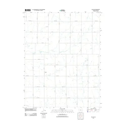
2012 Map of Iola SE
USGS Topo · Published 2012About this map
Salem Cem and the rural landscape southeast of Iola define this portion of Allen County, as it appeared in the early 21st century. The terrain is structured by a strict section-line road grid, with routes such as Maryland Rd, Connecticut Rd, and California Rd cutting through the agricultural heartland. The local aviation footprint is marked by the presence of Croisant Airport, a private airfield situated among the fields.
Find a feature on this map
26 named features on this map. Tap any name to fly to it.
Don’t see what you’re looking for? This feature index may not catch every label — zoom into the map to look around manually.
Map Details
Editions of this 2012 Iola SE Map
This is the sole edition of this map. No revisions or reprints were ever made.
Other maps of this area

1886 · Iola
USGS Topo · 1:125,000

1893 · Iola
USGS Topo · 1:125,000

1904 · Iola
USGS Topo · 1:125,000

1947 · Joplin
USGS Topo · 1:250,000

1948 · Erie
USGS Topo · 1:62,500

1949 · Erie
USGS Topo · 1:62,500

1949 · Joplin
USGS Topo · 1:250,000
1951 · Chanute
USGS Topo · 1:62,500

1954 · Joplin
USGS Topo · 1:250,000

1958 · Joplin
USGS Topo · 1:250,000