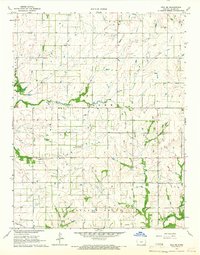
1965 Map of Iola SE
USGS Topo · Published 1967About this map
The Old Indian Treaty Boundary cuts across the southern portion of this Allen County landscape, marking a historical line of demarcation within the townships of Iola, Humboldt, Salem, and Cottage Grove. In the mid-1960s, this area was defined by a steady rural infrastructure of family-centric landmarks and energy extraction. Numerous Oil Wells and Gas Wells are scattered across the terrain, interspersed with an extensive network of pipelines and localized oil fields.
Find a feature on this map
21 named features on this map. Tap any name to fly to it.
Don’t see what you’re looking for? This feature index may not catch every label — zoom into the map to look around manually.
Map Details
Editions of this 1965 Iola SE Map
This is the sole edition of this map. No revisions or reprints were ever made.
Other maps of this area

1886 · Iola
USGS Topo · 1:125,000

1893 · Iola
USGS Topo · 1:125,000

1904 · Iola
USGS Topo · 1:125,000

1947 · Joplin
USGS Topo · 1:250,000

1948 · Erie
USGS Topo · 1:62,500

1949 · Erie
USGS Topo · 1:62,500

1949 · Joplin
USGS Topo · 1:250,000
1951 · Chanute
USGS Topo · 1:62,500

1954 · Joplin
USGS Topo · 1:250,000

1958 · Joplin
USGS Topo · 1:250,000