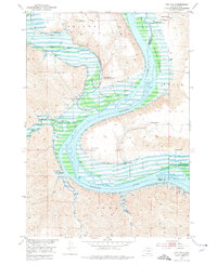
1952 Map of Iona NW
USGS Topo · Published 1976About this map
Missouri River meanders through this landscape on the border of Lyman and Brule counties, just before the construction of the Big Bend Dam would fundamentally alter the river's character. The map documents a period of transition, showing the Grandview Sch (Abandoned) while the Walker Sch remained active. The expansive Peterson Bottoms and Bird Island dominate the river channel, indicating the complex hydrology and siltation patterns of the era. Settlement is defined by family-run operations such as Close Ranch, Glaus Ranch, and Krammer Ranch, many of which were situated near Flowing Wells that tapped into the regional aquifer. This survey, conducted as part of the Department of the Interior program for the development of the Missouri River Basin, captures the early 1950s rural infrastructure before significant reservoir inundation downstream.
Find a feature on this map
20 named features on this map. Tap any name to fly to it.
Don’t see what you’re looking for? This feature index may not catch every label — zoom into the map to look around manually.
Map Details
Editions of this 1952 Iona NW Map
2 editions found
Other maps of this area

1935 · Chamberlain
USGS Topo · 1:62,500

1939 · Chamberlain
USGS Topo · 1:62,500

1940 · Iona
USGS Topo · 1:62,500

1944 · Iona
USGS Topo · 1:62,500

1952 · Reliance SE
USGS Topo · 1:24,000

1952 · Hamill NE
USGS Topo · 1:24,000

1952 · Oacoma
USGS Topo · 1:24,000

1952 · Iona NW
USGS Topo · 1:24,000

1955 · Mitchell
USGS Topo · 1:250,000

1959 · Mitchell
USGS Topo · 1:250,000