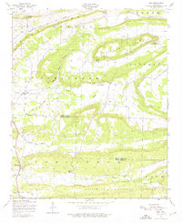
1947 Map of Ione
USGS Topo · Published 1976About this map
Petit Jean River meanders through this landscape on the border of Logan and Scott Counties, carving a path between the prominent ridges of Barber Ridge and Cauthron Mountain. The 1940s rural economy is evident through the scattered settlements of Ione, Lucas, and Elm Park, supported by the Chicago Rock Island and Pacific railroad line. Near Lucas, a local gin mill points to the area's agricultural activity during this era.
Find a feature on this map
28 named features on this map. Tap any name to fly to it.
Don’t see what you’re looking for? This feature index may not catch every label — zoom into the map to look around manually.
Map Details
Editions of this 1947 Ione Map
2 editions found
Other maps of this area

1879 · Poteau Mountain
USGS Topo · 1:62,500

1887 · Poteau Mountain #1
USGS Topo · 1:62,500

1887 · Mount Ida #2
USGS Topo · 1:62,500

1887 · Magazine Mountain #3
USGS Topo · 1:62,500

1887 · Magazine Mountain
USGS Topo · 1:62,500

1890 · Magazine Mountain
USGS Topo · 1:125,000

1890 · Mount Ida
USGS Topo · 1:125,000

1890 · Fort Smith
USGS Topo · 1:125,000

1890 · Poteau Mountain
USGS Topo · 1:125,000

1899 · Poteau Mountain
USGS Topo · 1:125,000