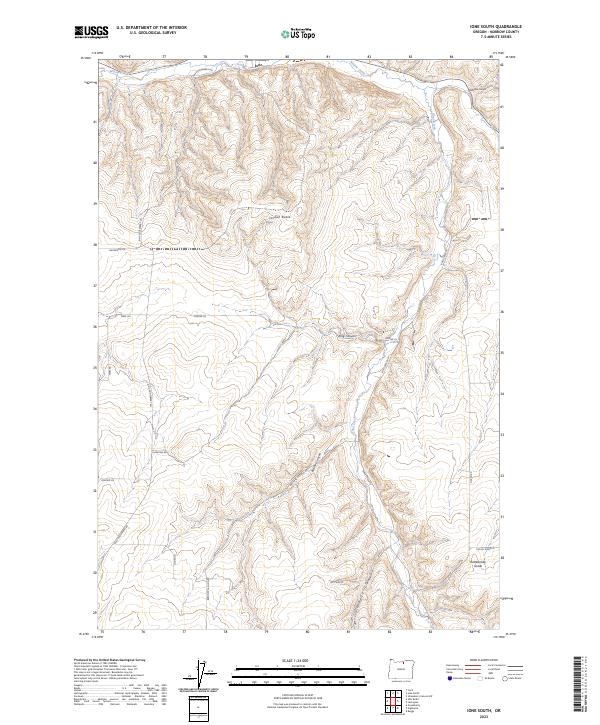
2023 Map of Ione South
USGS Topo · Published 2023About this map
Willow Creek and Rhea Creek carve through the high plateaus of Morrow County, defining the agricultural and transit patterns of this interior Oregon landscape. The small settlement of Ione sits at the northern edge of this sheet where the terrain begins its ascent toward prominent landmarks like Jordan Butte. The map reveals a network of roads named for local families and landmarks, such as Howton Rd, Kincaid Ln, and Halverson Ln, illustrating the historical division of the land into townships and ranges. To the southeast, the steep descent of Rattlesnake Grade emphasizes the dramatic elevation changes that characterize the region. The map also documents notable geographic features including King Canyon, Brenner Canyon, and the appropriately named Ke-ck Canyon, while the presence of Liberty School Rd suggests the historical locations of early community centers in this rural expanse.
Find a feature on this map
27 named features on this map. Tap any name to fly to it.
Don’t see what you’re looking for? This feature index may not catch every label — zoom into the map to look around manually.
Map Details
Editions of this 2023 Ione South Map
This is the sole edition of this map. No revisions or reprints were ever made.
Other maps of this area

1906 · Blalock Island
USGS Topo · 1:125,000

1908 · Blalock Island
USGS Topo · 1:125,000

1953 · Pendleton
USGS Topo · 1:250,000

1956 · Pendleton
USGS Topo · 1:250,000

1968 · Gooseberry
USGS Topo · 1:24,000

1968 · Lexington
USGS Topo · 1:24,000

1968 · Ione North
USGS Topo · 1:24,000

1968 · Eightmile
USGS Topo · 1:24,000
1968 · Utts Butte
USGS Topo · 1:24,000

1968 · Ruggs
USGS Topo · 1:24,000