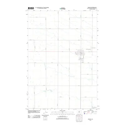
2012 Map of Ipswich
USGS Topo · Published 2012About this map
Ipswich serves as the primary hub of this Edmunds County landscape, organized by a precise grid of sectional roads and avenues. The settlement's residential and commercial core is concentrated around streets like Chestnut Ave and Broadway St, with aviation assets including Rappe Field Airport and TC Field Airport situated on its eastern periphery. To the south, the community's history is preserved at Southside Cem and Holy Cross Cem, while the agrarian character of the region is further evidenced by Pembroke Colony in the southeast corner.
Find a feature on this map
31 named features on this map. Tap any name to fly to it.
Don’t see what you’re looking for? This feature index may not catch every label — zoom into the map to look around manually.
Map Details
Editions of this 2012 Ipswich Map
This is the sole edition of this map. No revisions or reprints were ever made.
Other maps of this area

1899 · Ellendale
USGS Topo · 1:125,000

1899 · Northville
USGS Topo · 1:125,000

1954 · Aberdeen
USGS Topo · 1:250,000

1956 · Aberdeen
USGS Topo · 1:250,000

1970 · Mina SW
USGS Topo · 1:24,000

1970 · Mina NW
USGS Topo · 1:24,000

1970 · Leola SW
USGS Topo · 1:24,000
1974 · Ipswich SE
USGS Topo · 1:24,000
1978 · Stafford Dam
USGS Topo · 1:24,000

1978 · Beebe
USGS Topo · 1:24,000