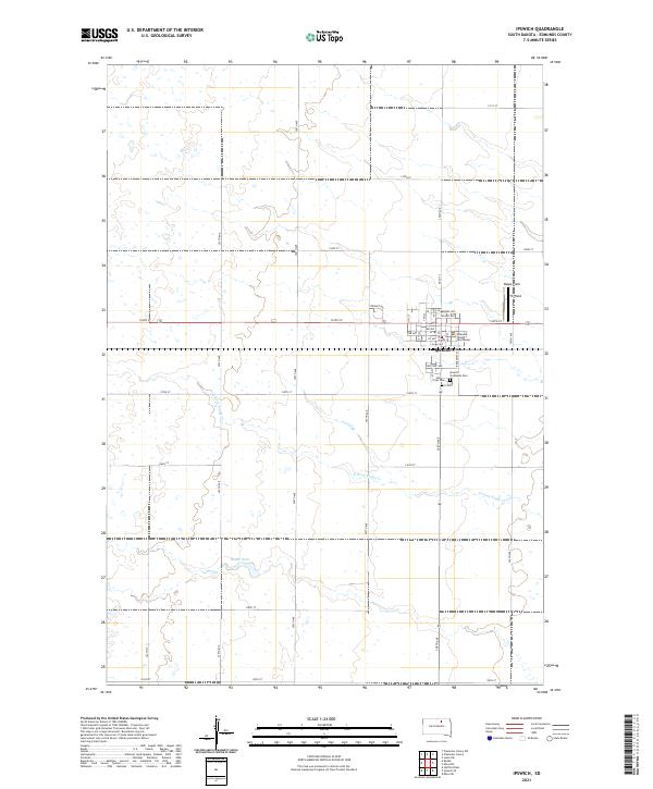
2021 Map of Ipswich
USGS Topo · Published 2021About this map
Ipswich serves as the focal point of this Edmunds County survey, centered at the intersection of 134th St and 358th Ave. The town layout is clearly defined, featuring the Edmunds County Courthouse at its heart. To the south of the residential core lie the Ipswich Southside Cem and Holy Cross Cem, while Rappe Field and TC Field are situated on the eastern outskirts, indicating the community's local infrastructure and recreational spaces. The surrounding landscape is characterized by its agricultural character and the drainage of the N Fork Snake Cr. Notable water management is evident at Blank Dam, which regulates local flow amidst the section lines of the Public Land Survey System. The map documents the persistent grid of rural roads and township boundaries like t123n r68w that have organized this prairie region for generations.
Find a feature on this map
39 named features on this map. Tap any name to fly to it.
Don’t see what you’re looking for? This feature index may not catch every label — zoom into the map to look around manually.
Map Details
Editions of this 2021 Ipswich Map
This is the sole edition of this map. No revisions or reprints were ever made.
Other maps of this area

1899 · Ellendale
USGS Topo · 1:125,000

1899 · Northville
USGS Topo · 1:125,000

1954 · Aberdeen
USGS Topo · 1:250,000

1956 · Aberdeen
USGS Topo · 1:250,000

1970 · Mina SW
USGS Topo · 1:24,000

1970 · Mina NW
USGS Topo · 1:24,000

1970 · Leola SW
USGS Topo · 1:24,000
1974 · Ipswich SE
USGS Topo · 1:24,000
1978 · Stafford Dam
USGS Topo · 1:24,000

1978 · Beebe
USGS Topo · 1:24,000