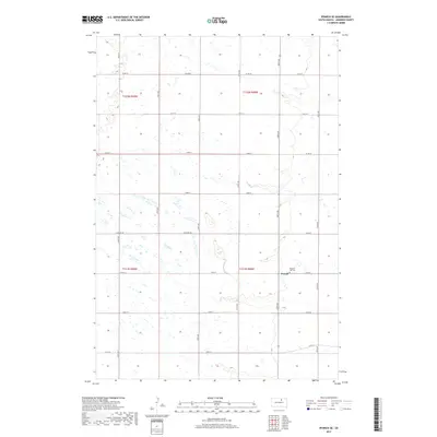
2017 Map of Ipswich SE
USGS Topo · Published 2017About this map
Powell remains a primary point of reference in this corner of Edmunds County, situated at the intersection of 145th St and 358th Ave. The surrounding landscape is defined by the high density of prairie potholes and small wetlands characteristic of the glaciated plains, which dictate the winding paths of rural roads like Loyalton Rd. Just west of the settlement, the Pleasant Hill Cem provides a focal point for genealogical interest, serving local families across several townships. The strict township and range grid, marked by boundaries like t121n r68w and t122n r69w, illustrates the enduring structure of South Dakota's land management and agricultural layout in the early twenty-first century.
Find a feature on this map
24 named features on this map. Tap any name to fly to it.
Don’t see what you’re looking for? This feature index may not catch every label — zoom into the map to look around manually.
Map Details
Editions of this 2017 Ipswich SE Map
This is the sole edition of this map. No revisions or reprints were ever made.
Other maps of this area

1899 · Northville
USGS Topo · 1:125,000

1952 · Norbeck
USGS Topo · 1:24,000

1952 · Wecota
USGS Topo · 1:24,000

1954 · Aberdeen
USGS Topo · 1:250,000

1956 · Aberdeen
USGS Topo · 1:250,000

1966 · Cresbard
USGS Topo · 1:24,000

1970 · Mina SW
USGS Topo · 1:24,000

1970 · Mina NW
USGS Topo · 1:24,000
1974 · Ipswich SE
USGS Topo · 1:24,000
1978 · Stafford Dam
USGS Topo · 1:24,000