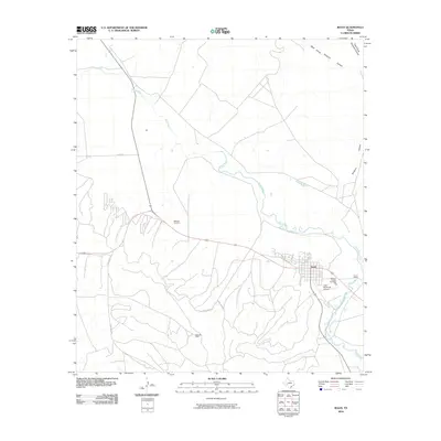
2010 Map of Iraan
USGS Topo · Published 2010About this map
The town of Iraan sits prominently on the southern banks of the Pecos River, serving as a central hub for the surrounding landscape of West Texas. This 2010 survey shows the tight grid of the town site positioned against the winding river corridor, with infrastructure such as the Iraan Municipal Airport and Camp Webb located just to the east. The legacy of the region's petroleum industry is clearly evidenced by the Yates Oil Field, which dominates the terrain to the southwest of the settlement. Local genealogists will find value in the documentation of the Restland Cemetery northwest of town and Memory Garden Cemetery near the eastern outskirts. The map also delineates the drainage patterns of the West Prong Simpson Canyon and East Prong Simpson Canyon as they cut through the plateau towards the river, while a network of rural roads including Long Loop Rd and Short Loop Rd connects the oil fields and ranchlands.
Find a feature on this map
12 named features on this map. Tap any name to fly to it.
Don’t see what you’re looking for? This feature index may not catch every label — zoom into the map to look around manually.
Map Details
Editions of this 2010 Iraan Map
This is the sole edition of this map. No revisions or reprints were ever made.
Other maps of this area

1928 · Crane
USGS Topo · 1:125,000

1928 · Rankin
USGS Topo · 1:125,000

1929 · Sheffield
USGS Topo · 1:125,000

1929 · Independence Draw Quadrangle
USGS Topo · 1:125,000

1954 · Pecos
USGS Topo · 1:250,000

1954 · Fort Stockton
USGS Topo · 1:250,000

1954 · Sonora
USGS Topo · 1:250,000

1954 · San Angelo
USGS Topo · 1:250,000

1957 · Pecos
USGS Topo · 1:250,000

1958 · Sonora
USGS Topo · 1:250,000