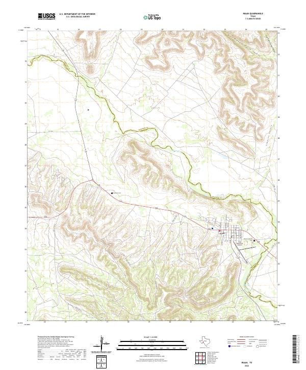
2022 Map of Iraan
USGS Topo · Published 2022About this map
Iraan serves as the primary settlement on this West Texas landscape, positioned near the junction of Pecos and Crockett counties. The town's layout is defined by residential streets such as Kniveton St, Blanton St, and Farr St, with the Iraan Municipal Airport and Memory Garden Cem marking the eastern periphery. The surrounding terrain is heavily dissected by the massive Simpson Canyon system, including its West Prong and East Prong, which carve deep drainage patterns through the high ground. To the northwest, the Pecos River snakes through the valley, while the presence of Restland Cem and isolated routes like Long Loop Rd and Short Loop Rd indicate a landscape shaped by rural infrastructure and local burial grounds. The playful naming of Alley Oop Ln reflects the local character and history of this Permian Basin community.
Find a feature on this map
22 named features on this map. Tap any name to fly to it.
Don’t see what you’re looking for? This feature index may not catch every label — zoom into the map to look around manually.
Map Details
Editions of this 2022 Iraan Map
This is the sole edition of this map. No revisions or reprints were ever made.
Other maps of this area

1928 · Crane
USGS Topo · 1:125,000

1928 · Rankin
USGS Topo · 1:125,000

1929 · Sheffield
USGS Topo · 1:125,000

1929 · Independence Draw Quadrangle
USGS Topo · 1:125,000

1954 · Pecos
USGS Topo · 1:250,000

1954 · Fort Stockton
USGS Topo · 1:250,000

1954 · Sonora
USGS Topo · 1:250,000

1954 · San Angelo
USGS Topo · 1:250,000

1957 · Pecos
USGS Topo · 1:250,000

1958 · Sonora
USGS Topo · 1:250,000