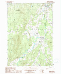
1986 Map of Irasburg
USGS Topo · Published 1986About this map
The Black River meanders through the heart of this Vermont landscape, defining the valley floor between the Lowell Mountains and the eastern uplands. In the mid-1980s, the settlement of Irasburg served as a central point for this agricultural and timber-rich region of Orleans County, with its village layout situated near the confluence of the river and Lords Creek. The terrain is marked by numerous family-named landmarks and water bodies, including Chamberlain Hill, Allen Hill, and Potters Pd, reflecting a long history of local land use and naming conventions.
Find a feature on this map
33 named features on this map. Tap any name to fly to it.
Don’t see what you’re looking for? This feature index may not catch every label — zoom into the map to look around manually.
Map Details
Editions of this 1986 Irasburg Map
This is the sole edition of this map. No revisions or reprints were ever made.
Other maps of this area

1919 · Lake Memphremagog
USGS Topo · 1:62,500

1920 · Derby
USGS Topo · 1:62,500

1920 · Irasburg
USGS Topo · 1:62,500

1923 · Irasburg
USGS Topo · 1:48,000

1923 · Lake Memphremagog
USGS Topo · 1:48,000

1925 · Irasburg
USGS Topo · 1:62,500

1925 · Memphremagog
USGS Topo · 1:62,500

1928 · Hardwick
USGS Topo · 1:62,500

1934 · Hardwick
USGS Topo · 1:48,000

1935 · Lyndonville
USGS Topo · 1:48,000