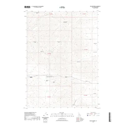
2020 Map of Ireland Springs
USGS Topo · Published 2020About this map
Pleasantview Hills dominate the high ground of this Oneida County landscape, where complex drainage systems like John Evans Canyon and West Elkhorn Canyon cut through the Idaho terrain. The settlement at Ireland Springs sits near the western edge of the quadrangle, flanked by Upper Spring and Lower Spring. This area serves as a critical geographic transition, marked by the prominent Holbrook Summit and the eastern passage through Malad Pass into the Malad Valley. The map detail traces the winding routes of local thoroughfares such as Pocatello Valley Rd and W 2000 S, which connect the isolated canyons and hollows. Genealogists and local historians can use these records to pinpoint specific family-named landmarks like Mansfield Canyon and the North Fork John Evans Canyon, reflecting the legacy of early land claims and ranching in the region.
Find a feature on this map
27 named features on this map. Tap any name to fly to it.
Don’t see what you’re looking for? This feature index may not catch every label — zoom into the map to look around manually.
Map Details
Editions of this 2020 Ireland Springs Map
This is the sole edition of this map. No revisions or reprints were ever made.
Other maps of this area

1954 · Pocatello
USGS Topo · 1:250,000

1958 · Pocatello
USGS Topo · 1:250,000

1963 · Daniels
USGS Topo · 1:24,000

1968 · Ireland Springs
USGS Topo · 1:24,000

1968 · Grover Canyon
USGS Topo · 1:24,000

1968 · Samaria
USGS Topo · 1:24,000

1968 · Daniels
USGS Topo · 1:24,000

1968 · Malad City West
USGS Topo · 1:24,000
1968 · Elkhorn Peak
USGS Topo · 1:24,000
1973 · Sheep Creek Spring
USGS Topo · 1:24,000