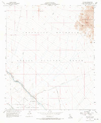
1956 Map of Iris Wash
USGS Topo · Published 1973About this map
The Chocolate Mountains dominate the eastern landscape of this mid-century survey, a region largely defined by military activity and desert water management. Much of the territory falls within the Chocolate Mountain Aerial Gunnery Range, emphasizing the area's strategic use during the Cold War era. To the southwest, the Camp Dunlap Naval Reservation and the former Camp Dunlap (Site) mark the site of significant naval training infrastructure.
Find a feature on this map
19 named features on this map. Tap any name to fly to it.
Don’t see what you’re looking for? This feature index may not catch every label — zoom into the map to look around manually.
Map Details
Editions of this 1956 Iris Wash Map
Other maps of this area

1940 · Iris
USGS Topo · 1:62,500

1940 · Frink
USGS Topo · 1:62,500

1940 · Iris Pass
USGS Topo · 1:62,500

1944 · Calipatria
USGS Topo · 1:62,500

1944 · Frink
USGS Topo · 1:62,500

1945 · Iris Pass
USGS Topo · 1:62,500

1945 · Iris
USGS Topo · 1:62,500

1954 · Salton Sea
USGS Topo · 1:250,000

1955 · Tortuga
USGS Topo · 1:24,000

1955 · Salton Sea
USGS Topo · 1:250,000