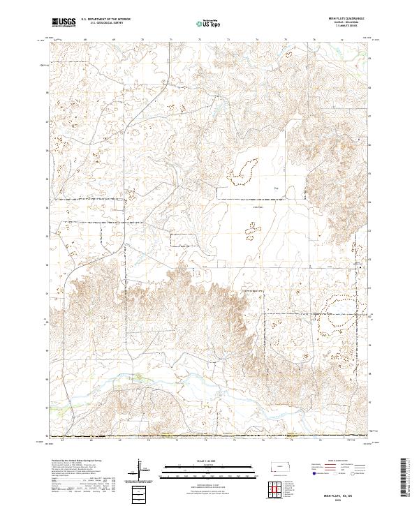
2022 Map of Irish Flats
USGS Topo · Published 2022About this map
Cimarron River meanders through the southern reaches of this landscape, marking a significant hydrologic boundary where the high plains of Kansas meet the Oklahoma border. The area is defined by its drainage systems, including the aptly named Skunkie Arroyo, Shorts Cr, and Crooked Cr, which carve into the terrain surrounding the broad expanse of Irish Flats. This geography reflects the agricultural and pastoral patterns typical of the High Plains, where human settlement is sparse and tied to the grid of rural roads like DD RD and GG RD. One of the few localized landmarks of cultural and genealogical significance is the Elsie Chapel Cem, a quiet site situated on the eastern edge of the survey area, providing a point of historical continuity for the surrounding rural community.
Find a feature on this map
22 named features on this map. Tap any name to fly to it.
Don’t see what you’re looking for? This feature index may not catch every label — zoom into the map to look around manually.
Map Details
Editions of this 2022 Irish Flats Map
This is the sole edition of this map. No revisions or reprints were ever made.
Other maps of this area

1892 · Meade
USGS Topo · 1:125,000

1954 · Perryton
USGS Topo · 1:250,000

1955 · Dodge City
USGS Topo · 1:250,000

1958 · Perryton
USGS Topo · 1:250,000

1958 · Dodge City
USGS Topo · 1:250,000

1959 · Dodge City
USGS Topo · 1:250,000

1962 · Irish Flats NE
USGS Topo · 1:24,000

1962 · Irish Flats SE
USGS Topo · 1:24,000

1963 · Kismet SE
USGS Topo · 1:24,000

1963 · Kismet NE
USGS Topo · 1:24,000