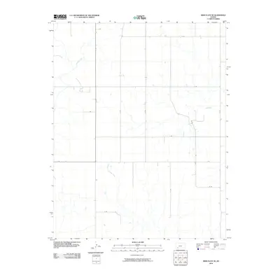
2010 Map of Irish Flats NE
USGS Topo · Published 2010About this map
Crooked Creek snakes through this high plains landscape in Meade County, defining the local drainage patterns long before the 2010 survey period. This part of Kansas is characterized by its strict section-line road network, where routes like 19 Rd and 21 Rd intersect with lateral paths such as V Rd and X Rd. The terrain is marked by subtle shifts in elevation around Sand Creek, illustrating the transition from agricultural tablelands to the shallow draws of the Cimarron River watershed. While sparse in named settlements, the map reveals the precise placement of ranch structures and irrigation patterns essential to the region's cattle and wheat economy during the early 21st century.
Find a feature on this map
15 named features on this map. Tap any name to fly to it.
Don’t see what you’re looking for? This feature index may not catch every label — zoom into the map to look around manually.
Map Details
Editions of this 2010 Irish Flats NE Map
This is the sole edition of this map. No revisions or reprints were ever made.
Other maps of this area

1892 · Meade
USGS Topo · 1:125,000

1955 · Dodge City
USGS Topo · 1:250,000

1958 · Dodge City
USGS Topo · 1:250,000

1959 · Dodge City
USGS Topo · 1:250,000

1962 · Irish Flats NE
USGS Topo · 1:24,000

1962 · Irish Flats SE
USGS Topo · 1:24,000

1963 · Lake Larrabee
USGS Topo · 1:24,000

1963 · Irish Flats
USGS Topo · 1:24,000

1963 · Meade
USGS Topo · 1:24,000

1963 · Missler
USGS Topo · 1:24,000